The new structure of the International Association of Geodesy (IAG) viewed from the perspective of history
(1) Astronomical Institute, University of Bern, Sidlerstrasse 5, CH – 3012 Bern, Switzerland
e-mail: gerhard.beutler@aiub.unibe.ch, andreas.verdun@aiub.unibe.ch
(2) Deutsches Geodätisches Forschungsinstitut, Marstallplatz 8, D – 80539 Munich, Germany
e-mail: drewes@dgfi.badw.de
Abstract. The IAG Executive Committee and the IAG Council decided to invoke a thorough review of the IAG and its structure with the goal to create a new, hopefully simpler structure, meeting the needs of the 21st century, at the IAG General Assembly in Birmingham in 1999. The new structure was implemented in 2003 at the XXIII-rd IUGG General Assembly in Sapporo. The new structure should
- have a focus
- be based on the three pillars of modern geodesy, namely the geometric shape of the Earth, the orientation of the Earth in space, and the Earth’s gravity field, and
- better incorporate the IAG services
The new structure may be viewed as an attempt to go back to the roots of the IAG, as they were designed and realized by the eminent geodesists and practitioners of the 19th century.
There are remarkable parallels between this first IAG structure and that of 2003: The focus of IAG in the 19th century was the Central European Arc Measurement, in the 21st century it is the Integrated Global Geodetic Observing System (IGGOS). The creation of the International Lati-tude Service (ILS) was a proud achievement of the “old” IAG, today's IAG services are the modern counterpart. The goals of the 19th century IAG were technically achieved by optical (astrometric) observations and politically by interna-tional collaboration. The modern tools are the space geode-tic techniques (geometric and gravitational), nothing changed on the political level: Only international coordina-tion and collaboration and long-lasting institutional com-mitments promise satisfactory results.
Keywords. Earth observing systems, reference systems, Earth rotation, gravity field, history of geodesy
1 Geodesy and IAG
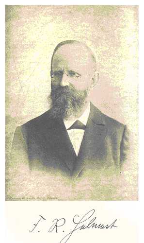 By the mid-19th century geodesy was established as an independent scientific discipline with a theoretical founda-tion (containing specialized concepts) and with dedicated observation methods. In the 1880s, Friedrich Robert Hel-mert (see Fig.1) compiled and refined the mathematical and physical theories related to geodesy in his two-volume oeuvre Helmert (1880). He defined the so-called higher geodesy as the methods to determine the equipotential sur-faces and to measure parts of the Earth's surface of arbi-trary size by horizontal projection and heights considering the shapes of the equipotential surfaces.
According to Torge (2001) and (Torge1996), geodesy is the science of the measurement of the Earth's surface and its external gravity field including temporal variations. If “measurement of the Earth” is understood to include also the orientation of the Earth in inertial space, then the above definition may be considered as valid for our purpose. Modern geodesy is based on three pillars, namely
- The geometric shape of the Earth (land, ice, and ocean surface) as well as its variations with time,
- The orientation of the Earth in space as a function of time (described by the Earth rotation parameters precession, nutation, length of day, and polar motion), and
- The Earth's gravity field and its temporal variations.
This definition of modern geodesy was put forward by Rummel et al. (2002), who also made the following pro-posal in the same article: We propose, as a candidate IAG project, an Integrated Global Geodetic Observing System (IGGOS). IGGOS should combine - with utmost precision and consistency - the three fundamental areas of geodetic research into one integrated global observation and analy-sis system for Earth sciences. The level of relative precision and consistency was specified to be at least at the order of 10-9. What is the motivation to invoke a large-scale experi-ment like IGGOS? There were - as often in such cases - many reasons. Let us give three, which we believe to have been of central importance:
- It was inspiring that Prof. Klaus-Peter Schwarz, presi-dent of the Association between 1996 and 2000, was convinced that the Association would need a new focus in the new millennium. His questions, concerns, and his convincing power led, among others, to the organi-zation of the IAG Section II Symposium in Munich in October 1998 (documented in Rummel et al. (2000). Many ideas, how to reorganize IAG and how to realize IGGOS within the Association, were discussed for the first time at this symposium. The name Integrated Glo-bal Geodetic Observing System and the corresponding acronym IGGOS were coined in 1998 in Munich. It was understood, from this point in time onwards, that IGGOS should be considered as the focus for most of the IAG activities.
- The five-section structure of the IAG was implemented already in 1951 at the General Assembly in Brussels and the most recent serious review of the structure took place at the General Assembly in Hamburg in 1983. This development is documented by Table 1 (taken from Beutler2000). Many important developments, mainly due to the advent of the space age and the ad-vancement of measuring technology, were not reflected by the IAG structure implemented in 1951 or in 1983.
- According to Levallois (1980), the IAG Sections should define the fundamental directions for geodesy and give as complete a picture as possible of current research and results in their fields. Attached to the sections there could be commissions and special study groups. The commissions had the task of dealing with special problems requiring coordinated international action. Often they were centered around a permanent bureau, implying that commissions had a permanent status, as well.
There was overlap between the sections, but there was no such thing as a focus for the entire association. The definition of the essential research topics was left to the five sections. We conclude therefore that the idea of one focal point for the entire association did not exist (nor did it play any role) in the structure established in 1983. The so-called “permanent bureaus” were not considered directly as a part of the Association, but only indirectly through the commissions. This set-up assumes that the permanent bureaus have “only” routine and organizational tasks, but certainly no re-search duties. Research should be performed in the sections, in particular in the study groups.
With the advent of the new space geodetic services, in particular the IERS and the IGS (International GPS Service), the assumptions underlying the old IAG structure were no longer valid: The space geodetic ser-vices are most actively involved in geodetic research one might even say that they lead the research in important areas and that they are very close to what might be the new IAG focus. This new and exiting development was not at all reflected by the old IAG structure. The service-related aspects will be further discussed in Chapter 4.
| Section | Year | Title |
|---|---|---|
| I | 1951 1971 1983 |
Triangulation Control Surveys Positioning |
| II | 1951 1971 1983 |
Precise Leveling Satellite Surveys Advanced Space Technology |
| III | 1951 1971 1983 |
Geodetic Astronomy Gravimetry Determination of the Gravity Field |
| IV | 1951 1971 1983 |
Gravimetry Theory and Evaluation General Theory and Methodology |
| V | 1951 1971 1983 |
Geoid Physical Interpretation Geodynamics |
It became clear at the Munich Section II symposium in 1998, that not only a new focus, but an entire new IAG structure, allowing the Association to focus on a central issue, was required. This is why the IGGOS project and the new IAG structure cannot be separated from each other. At the IAG General Assembly in Birmingham in 1999 the result of four years of analyses of the IAG were presented and discussed at the symposium called IAG structure to meet future challenges. It was decided that an IAG Review Committee should be given the task to come up with a proposal for a new IAG structure at the IAG Scientific Meeting in 2001 in Budapest. The IAG Review Committee organized a retreat in February 2000, where experts from geodesy, Earth sciences, government organizations, etc. were invited to develop, together with the committee, a first proposal for the new structure. The committee did then complete its work in a series of meetings, documented its findings in Beutler (2002), drafted new IAG statutes and ByLaws (see IAG homepage, http://www.gfy.ku.dk/~iag/), and presented its work for approval to the IAG Executive Committee and the IAG Council in September 2001 in Budapest. After slight revisions the proposal was approved. The new IAG consists of
- Commisions
- Services
- A Communication and Outreach Branch
- IGGOS as IAG’s first project.
The four elements are represented in the IAG Executive Committee. Commissions and services thus are on the same level in the new IAG structure. Moreover, the new Statutes and ByLaws allow it to create an IAG project and so-called inter-commission committees. More details about the new IAG structure may be found in Beutler (2002) and Beutler (2003).
The attempt to establish IGGOS as IAG's first (and only) project should be compared to the creation of the IAG itself in 1864. This aspect will be further pursued in Chapter 2.
The proposal put forward by the IGGOS planning group to the IAG Executive Committee and the IAG Council at the IAG General Assembly in Sapporo contains definition, vision, and mission statements. Moreover, the objectives are specified, a science rationale is provided, and the plan to implement IGGOS is specified. For the complete infor-mation we refer to the original text of the proposal (see IAG homepage, http://www.gfy.ku.dk/~iag/). Here we confine ourselves to reproduce the definition statement:
Definition: IGGOS stands for Integrated Global Geodetic Observing System. System should be understood as the basis on which the future advances in geosciences can be built. By considering the Earth system as a whole (including solid Earth, atmosphere, ocean, hydrosphere, ice, liquid core, etc.), monitoring it by geodetic techniques and by studying it from the geodetic point of view, the geodetic community does provide the global geosciences community with a powerful tool consisting mainly of high quality services, standards and references, and theoretical and observational innovations….
IGGOS has a central theme, namely Global deformation and mass exchange processes in the System Earth. Under the umbrella of geometry plus Earth rotation plus gravity field, this theme encompasses virtually all facets of geodesy. In addition, it may easily be translated and broken down into tangible individual sub-themes and products.
IGGOS will be based on the existing IAG Services. It will provide a framework for existing or future services and wants to ensure their longterm stability. IGGOS must be recognized by partners outside IAG, e.g., by UNESCO, ICSU (International Council of Science), IGOS (the United Nations' Integrated Global Observing Strategy), governments, intergovernment organizations, WCRP (World Cli-mate Research Program), IGBP (International Geosphere Biosphere Program), etc., as geodesy's most important con-tribution to Earth sciences.
The initial structure to be established for the IGGOS definition phase is simple and compatible with the existing IAG services. The key elements of the initial IGGOS structure are:
- The IGGOS Project Board as the central oversight entity.
- Few well-defined Working Groups. The tasks of the working groups are to a high degree independent of the tasks of the IAG services.
- An IGGOS Science Council representing the geodetic community.
More details may be found in the IGGOS description in this volume.
2 General Baeyer’s magnificent enterprise
 The history of the IAG till 1996 is very well documen-ted by Levallois (1980) and Torge (1996). Our main inte-rest is related to possible parallels between the birth of the Association and its new structure - if there are any. Our interest was stimulated by the article by Schwarz (2000), who wrote:
“The impetus for organizing the international scientific work in geodesy came from J. J. Baeyer, who in 1861, at the age of 66, sent his famous memorandum to the King of Prussia urging the establishment of the Central European Arc Measurement….Baeyer (1861) states:
In this framework, one could compute about 10 meridi-an arcs at different longitudes and even more parallel arcs at different latitudes; it would also be possible to compare the curvature of the meridians on both sides of the alps, to study the effect of the alpine ranges on the deflections of the vertical and to determine the curvature of the Adriatic and the Mediterranean, as well as the North Sea and the Baltic; in a word, there is a wide field for scientific investigations which have not been considered in any of the arc measu-rement campaigns and which, no doubt, will lead to inte-resting and important results…If Central Europe is there-fore willing to unite and use its resources for the solution of this task, it will call into being an important and magni-ficent work....
The new set of questions that Baeyer proposed to ask had to do with the Earth as a system. He established as guiding principles that the system Earth
- Must be considered as consisting of the solid Earth and the oceans.
- Could be determined by measurement, of both the geo-metric and gravimetric variety.
- Required the integration of existing components, to provide new insights.
- Needed international cooperation and a scientific orga-nization.
These principles created a focus for geodetic research that could still be felt fifty years later when the First World War interrupted this development.”
3 General Baeyer’s magnificent enterprise and IAG in the 21st century.
The above quotations from Schwarz (2000) may be viewed as the justification from the historical point of view of the new IAG with IGGOS as its central theme. Let us further investigate the parallels between Baeyer's “magnifi-cent enterprise” and the more prosaic IGGOS (at least when judged from the naming point of view).
In 1861 Baeyer was a retired general of the Prussian army, well aware of the engineering, military and economic implications of his proposal. The engineering part of IGGOS is important, as well: The second half of the 20th century has seen an unprecedented development of new measurement techniques in geodesy. Extensive use is made of global satellite navigation systems like the GPS (the U.S. Global Positioning System), the Russian counterpart GLONASS, the French system DORIS, and the future European system GALILEO. These systems were neither designed nor are they maintained for scientific reasons, but for everyday applications like airplane and car navigation, hiking and biking, positioning, etc., and (at least for the first two systems) for military use. They must be complemented, for practical reasons, as well, by precise gravity observation systems (terrestrial, airborne, spaceborne) in order to allow for the determination of physical heights, which matter for many engineering applications.
The proposers of the new IAG structure and of IGGOS are convinced - exactly as General Baeyer was in his epoch - that the available magnificent geodetic high precision instruments must be used for the benefit of science and society - in particular for Earth sciences and astronomy (many of the methods developed in space geodesy could, e.g., be used for determining size, figure, orientation, and gravity field of the Moon, or other planets of the solar system).
What Baeyer proposed, and what was eventually reali-zed, was neither the first arc measurement, nor were the first gravimetric measurements performed in the context of the Central European Arc Measurement. The new aspect of the enterprise was the use of mature geodetic measurement techniques and the standardization of observation and ana-lysis, which allowed it to focus on scientific issues, rather than on measurement technology.
A similar situation is encountered today: The revolutionary geodetic techniques designed and deployed in the second half of the twentieth century are mature (or are about to become mature). Their scientific exploitation asks for a magnificent enterprise in the sense of Baeyer. The “initial conditions” for IGGOS may be summarized as follows:
- With the advent of the space age in 1957 satellite geo-desy was developed as a new branch of science. Satel-lite geodesy uses artificial satellites either as measure-ment targets or as measurement platforms. Thanks to the relative closeness of the targets (“only” a few thousand kilometers) and thanks to new developments in physics, alternative measurement techniques even-tually replaced the one and only technique in astrono-mical geodesy (geodetic astronomy), namely the astro-metric determination of the direction of the observer to the celestial object at a particular point in time. The Laser technology could be used to measure precise dis-tances between observatories and satellites (today with a typical accuracy of 1 cm), crystal oscillators and atomic clocks opened the way for using microwave signals (emitted by artificial satellites) to measure dis-tance differences referring to two different epochs and one pair “satellite-receiver”.
- The celestial reference frames, previously (from the stone age up to the second half of the 20th century) realized by observing the directions to so-called funda-mental stars with optical means, is today defined and maintained by simultaneously observing Quasars (Quasi-stellar radio sources) from different radio-astronomical observatories by using the Very Long Baseline Interferometry (VLBI) technique.
- In the determination of the Earth's gravity field (the third pillar of modern geodesy) the (r)evolution due to the advent of the space age was perhaps even more spectacular than in the area covered by the first two pillars. The revolution took place in three steps:
- Whereas only the mass of the Earth and the (dyna-mical) flattening (corresponding to the C00 and C20-terms of a spherical harmonics expansion of the Earth's gravity potential) were reliably known be-fore 1957, hundreds of terms emerged from the analysis of the orbits of geodetic satellites using Laser, Doppler, (initially also astrometry) as obser-vation techniques.
- With the uninterrupted tracking of low satellite or-bits using spaceborne GPS receivers, the gravity field can be determined with unprecedented accu-racy. This is proved with the first results of the German CHAMP mission.
- With the advent of satellite gradiometry (based either on extremely precise distance measurements between neighboring low orbiters or on gradiome-ters realized by a set of accelerometers within one and the same satellite), the Earth's gravity field and its temporal variations may be determined with unprecedented accuracy and (temporal and spatial) resolution. Temporal variations, e.g., caused by the re-distribution of mass in the Earth system consis-ting of solid Earth, ice fields, oceans, and atmo-sphere, are the key objective of the GRACE mis-sion. Using gradiometry based on acceleometers it is also possible to determine the stationary part of the Earth's gravity field with unprecedented accura-cy the primary goal of ESA's GOCE mission.
- Triangulation (i.e., the fine art of establishing geodetic networks of regional or even continental size) was well established when Baeyer made his proposal. The tools to measure absolute gravity were a bit lagging behind in the development. It was an essential element of Baeyer's proposal to include both techniques. The situ-ation is similar today: the geometry-related IAG ser-vices IGS, ILRS, and IVS monitor (point-wise) the geometrical aspects of the system Earth already now on the 10-9-level. The gravity-related results are about to reach this level with the series of space missions CHAMP, GRACE, and GOCE. Again we are in a situation, where the geometrical aspects related to the system Earth are better established than those related to gravity.
- The consistency of the geometrical and gravity-related methods and results was considered only implicitly and as a side issue in Baeyer's proposal. Within IGGOS consistency of geometry and gravity is a central, pro-bably even the key element. For all applications re-quiring the knowledge of equipotential surfaces, thus in particular for all research related to global change, this consistency is a prerequisite. Take altimetry as an example! If this consistency, compatible with the ac-curacy achieved in geometry and in gravity, cannot be guaranteed, sea level changes, ocean currents, etc., cannot be established properly.
4 The IAG services
The incorporation of the IAG services was one of the key element of the IAG restructuring process 1999-2003. Let us therefore briefly review the development of (some of) these IAG units. The history of the IAG services told here is based on information contained in the documen-tation Mueller (1998), and on the articles, Mueller (2000), Guinot (2000), Wilkins (2000), Yokoyama (2000) and Beutler (2000).
Table 2 from Beutler (2000) lists the currently active IAG services. We should mention that many of them are “not only” linked to the IAG (or, what we consider to be equivalent, to IUGG, the International Union of Geodesy and Geophysics), but also to other scientific associations. The IERS and the IVS, e.g., are services of the IAU, the International Astronomical Union, as well, and the PSMSL, the Permanent Service for Mean Sea Level, is also res-ponsible to IAPSO, the International Association for the Physical Sciences of the Ocean. Most of the services are, moreover, working under the auspices of FAGS, the Fe-deration of Astronomical and Geophysical Data Analysis Services.
It is our understanding that a new IAG service should only be created, if its products are well defined, regularly gene-rated, and of importance for a larger user community. The services are very different in age (the ILS, one of the pre-decessors of the IERS, started operations in 1899, the IBS (International Bibliographic Service) has roots going back to 1889, whereas the ILRS and the IVS were founded shortly before the end of the 20th century). It is, however, interesting to note that even the oldest services are today modern IAG services in the sense mentioned above.
| Service | Type | Short Name |
|---|---|---|
| IERS IGS ILRS IVS BIPM PSMSL | Geom Geom Geom Geom Geom Geom | Int. Earth Rotation and Reference System Service Int. GPS Service Int. Laser Ranging Service Int. VLBI Service Int. Bureau of Weight and Measures Permanent Service for Mean Sea Level< |
| ICET BGI IGeS |
Grav* Grav* Grav* |
Int. Centre for Earth Tides Int. Gravimetric Bureau Int. Geoid Service |
| IBS/- IBS/- |
Doc Doc |
IAG Bibliographic Service Information Service |
| * = now part of IGFS |
There are three types of services, one related to (a) geometry, one to (b) gravity, and one to (c) documentation and information. Only the first two types will be further considered here. The distinctions between the first two types are in some cases arbitrary. There are, e.g., geometric and gravity aspects when studying Earth tides (in the case of the ICET, the International Centre of Earth Tides).
Let us first briefly address the gravity-related services. An interesting and promising development took place very recently: The International Gravity Field Service (IGFS), consisting of
- Bureau Gravimetrique International (BGI)
- International Centre of Earth Tides (ICET)
- International Geoid Service (IGeS) I, in Milano
- International Geoid Service (IgeS) II, at NIMA
- International Centre of Global Earth Models (ICGEM) at GFZ
was created recently to meet the challenges of the decade of gravity marked by the German research satellite CHAMP (launched 2000), the U.S./German mission GRACE (launched 2002), and the European mission GOCE (to be launched in 2005). It is expected that the newly created IGFS will play an active role from now on, comparable to that of the services related to space geodesy. The BGI and the ICET are the oldest parts of the new service.
The BGI, hosted by the French space agency CNES (Centre National d'Etudes Spatiales), was founded in 1951. The main task of BGI is to collect, on a worldwide basis, all existing gravity measurements and pertinent information about the gravity field of the Earth, to compile and store them in a machine readable data base in order to redistri-bute them to a large variety of users for scientific purposes. The data consist of gravimeter observations, mean or point-by-point free air gravity anomalies, and gravity maps. BGI also has at its disposal grids of satellite altimetry derived geoid heights from the Geosat, Topex-Poseidon, ERS1 and ERS2, Jason, and ENVISAT missions.
The ICET was founded in 1956 to collect all available measurements on Earth tides. The data are evaluated by convenient methods in order to reduce the very large amount of measurements to a limited number of parameters which should contain all the desired information. The data from different instruments and different stations all over the world are compared and their precision and accuracy is evaluated. The major objective is to help solving the basic problem of calibration by organizing reference stations or realizing calibration devices; to fill gaps in information and data; to build a data bank allowing immediate and easy comparison; and to ensure a broad diffusion of the results and information to all interested laboratories and individual scientists.
The IGeS was created in 1991 on the occasion of the IUGG General Assembly in Vienna as an operational group of the International Geoid Commission of IAG. The princi-pal objective is to work for the benefit of the international scientific community in general. Specific tasks are the col-lection and distribution of data and software for geoid com-putation as well as the performance of geoid computations in support of national and scientific objectives. At the IGeS section in Milano, emphasis is laid on the education and training aspects by organizing courses (International Schools) and issuing bulletins describing activities and in-formation available. The IGeS branch at NIMA is probably the biggest data generator and supplier worldwide.
Regarding the geometry-related entities in Table 2, one should make the distinction between technique-specific services and the IERS, which “blends” the results of the technique-specific services to generate a consistent set of Earth rotation parameters, a terrestrial and a celestial reference frame.
The PSMSL was established in 1933. It produces and analyzes in essence sea level records of hundreds of tide gauges over long time spans. The PSMSL data set repre-sents extremely important boundary conditions for global change analyses. The correct interpretation of the tide gauge signals is delicate. It is a recent development that the PSMSL and the IGS work closely together: With the GPS technique it is possible to describe independently the verti-cal motion of the tide gauge observatories.
The role of the BIPM time section (Bureau Internatio-nal de Poids et Mesures) is crystal clear: This section of BIPM generates and disseminates International Atomic Time (TAI) and the Coordinated Universal Time (UTC), where the “power” to introduce leap seconds is with the IERS. As UTC is derived today from atomic time (TAI) and no longer from monitoring Earth rotation (or other astronomical motions), the service is basically physical in nature. Its main concern is the combination of more than 200 atomic clocks worldwide. Therefore, there are impor-tant relationships between the BIPM and the IGS, because the GPS may be used to transfer time and frequency very accurately and efficiently between the time laboratories. The BIPM time section is the successor of the BIH, the Bureau International de l'Heure, which was created in 1912 to make use of the radio technique to synchronize clocks worldwide. Physically, the BIH was located at the Paris Observatory till 1985, when it became the time sec-tion of the BIPM. The BIH played a very active role in the transition phase from the IPMS to the IERS (to be dis-cussed below). At that time the BIH did not only have a time section, but an Earth rotation section, as well. The lat-ter branch of the BIH was melted with the newly estab-lished IERS in 1988.
The roots of the IERS go back to the year 1899, when the ILS, the International Latitude Service, was founded by the (predecessor of) the IAG. Its name is very appropriate: polar motion was derived from latitude observations perfor-med at (initially) six observatories (Mizusawa (Japan), Tschardjui (former USSR), Cagliari (Italy), Gaithersburg (USA), Cincinnati (USA), Ukiah (USA)). The Central Bureau of the ILS was initially located at the Geodetic Institute of Potsdam (Director F. R. Helmert, responsible C.T. Albrecht, then moved to Japan (Mizusawa) in 1922 with H. Kimura as director, then to Italy in 1935, to go back to Japan in 1962 with S. Yumi as director). The foundation of the ILS is clearly an IAG achievement. With the re-organization of the international scientific associations after the first world war, in particular with the creation of the IAU and the IUGG, the ILS became a service working under the auspices of the two big Unions. The IAG, now an Association of IUGG, was de facto responsible for the ILS together with the IAU. A serious review of polar motion work took place in the 1950s. It was decided to consi-derably expand the polar motion work and that the IPMS, the International Polar Motion Service, should succeed the ILS with a much expanded mandate (when compared to the ILS). The IPMS became a service under FAGS and should.
- Advance the study of all problems related to the motion of the pole
- Collect the astronomical observations which can be utilized for the determination of this motion
- analyze and synthesize them
- calculate the coordinates of the pole
- distribute the data required
- publish the initial data and obtained results.
This mandate is close in many aspects to the mandate of the IERS. It is interesting to note, however, that the celestial and terrestrial reference frames, implicitly needed for the work of the IPMS, were not explicitly mentioned in the above list. With the accuracy achievable within the new service, the celestial frame could be taken from astronomy (fundamental catalogs) and the (mean) terrestrial frame from geodesy.
The IPMS Central Bureau stayed in Japan with K. Yokoyama as director until the service was abolished by the end of 1987.
It is interesting to note that it was not the IPMS, which embraced the new space techniques, but that this mandate was given to the IAU/IUGG joint working group on the rotation of the Earth in 1978 with G. A. Wilkins as chair and I. I. Mueller as co-chair. This working group initiated and conducted the project MERIT (Monitoring Earth Rota-tion and Intercomparison of Techniques of observation and analysis). The BIH was the coordinating center of the pro-ject. All candidate techniques, in particular optical astrome-try, Doppler tracking of satellites, Satellite and Lunar Laser Ranging (SLR, LLR), and Very Long Baseline Interferome-try (VLBI) were invited to demonstrate their capabilities for Earth rotation monitoring. A so-called MERIT Short Cam-paign was held in 1980, followed by the MERIT main cam-paign from September 1, 1983 to October 31, 1984. The MERIT operations continued (on a best effort basis) there-after. Based on the experiences gained by the MERIT pro-ject and on recommendations made by the project team, the IAU and IUGG decided to set up the IERS (International Earth Rotation and Reference Systems Service), which started operations on January 1, 1988. The mandate of the IERS is to
- Define and maintain the International Celestial Refe-rence Frame (ICRF)
- Define and maintain the International Terrestrial Refe-rence Frame (ITRF)
- Monitor the Earth rotation parameters
- Define the standards, constants, models etc., required for Earth rotation work.
VLBI, SLR, LLR were the techniques originally considered by the IERS. It is interesting to learn from Wilkins (2000) that one option was to consider VLBI as the only technique to define Earth rotation. This solution would have been rather close to the original definition of the ILS, namely to determine polar motion using one technique only, and to base the service on a small number of “identical” observatories. In retrospective it was a wise decision to define the IERS as a multi-technique service. From our perspec-tive it would have been good to include astrometry as well. This would have added a completely independent technique to determine UT1. Also, the transfer problem of the celes-tial reference frame from the microwave to the optical do-main would have been solved in this way. Be this as it may: The understanding of the IERS as a multi-technique service made it very easy for GPS to become acknowledged as an official IERS technique in the 1990s.
The IGS, International GPS Service was established in the early 1990s. The IGS planning committee started working after the IAG Scientific Assembly 1989 in Edin-burgh under the leadership of I.I. Mueller. The committee wrote and sent out a call for participation for IGS stations, data centers, analysis centers, and central bureau, to take part in the IGS test campaign, and eventually in a future official IGS service. The response to the call for participa-tion was overwhelming: It became clear that the IGS net-work would consist of dozens of tracking sites distributed worldwide (the current network consists of more than 200 stations), of three global and many regional data centers, and of a handful of analysis centers. The IGS Central Bureau was to be located at JPL (Jet Propulsion Labora-tory) in Pasadena. At the IUGG General Assembly in Vienna, the IGS planning committee was dissolved and the so-called IGS Campaign Oversight Committee was created instead, with G. Beutler as chairman. It was the main pur-pose of this committee to organize a three-month IGS test campaign in 1992. The campaign was a great success. All analysis centers were capable of producing accurate GPS orbits (at least one order of magnitude better than the broadcast orbits) and, in addition, precise station coordina-tes, high-resolution polar motion and length of day data. The work of the IGS analysis center was regularly compa-red and evaluated by the analysis coordinator.
The 1992 IGS Test Campaign, scheduled for 21 June - 23 September 1992, was, as a matter of fact, so successful that it was decided to continue operations on a best effort basis after the official end of the 1992 campaign in the framework of a pilot service. The IGS products became more and more mature, robust, and reliable. It was therefore only natural that the IAG Executive Committee, at its meeting in 1993 in Beijing, decided to establish the IGS as an official IAG service, with official starting date on January 1, 1994. It was also decided that the IGS analysis coordinator, Jan Kouba from Canada, should not only com-pare and evaluate the analysis centres' products, but in addition come up with official IGS products, which should be based on all individual solutions. This strategic decision was essential to make IGS products accurate, robust, and clearly understandable for the wider user community (scientific and commercial). The oversight committee was replaced by the IGS Governing Board with G. Beutler as its first chair. Beutler was succeeded by Prof. Ch. Reigber in 1999, who in turn was succeeded by Prof. J. Dow in 2003.
The IGS is a truly interdisciplinary service of IAG: GPS orbits, station coordinates and velocities, time transfer para-meters, global ionosphere models, integrated water vapor content (for selected ground stations) are regularly deter-mined by the IGS. This aspect of the IGS is documented in Beutler (1999). The IGS was (and is) widely recognized to be a model service of IAG.
The International VLBI Service for Geodesy and Astrometry (IVS) started its official operations as an IAG service on March 1, 1999. It is the successor of the CSTG (International Coordination of Space Techniques for Geodesy and Geodynamics) subcommission on VLBI, which is in turn the successor of the so-called IRIS (International Radio Interferometric Surveying) subcommission of CSTG, established at the IUGG General Assembly in Hamburg. The IRIS subcommission played an essential role during the MERIT campaign for demonstrating the power of the new space geodetic techniques for Earth rotation monito-ring and for the establishment of the celestial and terrestrial reference frames. Today, the IVS is the service officially recognized by IUGG and IAU for the definition and main-tenance of the celestial reference frame. Moreover, the (un-biased) determination of UT1-UTC and of precession and nutation, is performed by this service. The VLBI technique was developed by NASA. Today, Japanese and Canadian developments are of greatest importance in this domain, as well. Exactly like the IGS, the IVS is a single-technique service. Its terms of reference and structure are rather similar to those of the IGS.
The International Laser Ranging Service (ILRS) started official operations in fall 1998. The ILRS is the successor of the CSTG subcommission on satellite and lunar laser ranging, which was established in early 1986 as the Satellite Laser Ranging subcommission in 1986. Exact-ly like the IRIS subcommission, the SLR subcommission played an important role during the MERIT campaign. To-day, the ILRS analyses define (in essence) the scale and origin of the ITRF, the IERS terrestrial reference frame. SLR/LLR can play this role, because atmospheric refraction may very well be modelled with sub-cm accuracy by using standard meteorological equipment (measuring pressure, temperature, and humidity recorded at the observing sites). As seen from the IGGOS perspective, the ILRS and its con-tributions calibrate the microwave observing systems GPS and VLBI. It should be pointed out in addition that prior to the launch of the CHAMP, GRACE, and GOCE missions our knowledge of the Earth's global gravity field was essentially based on SLR/LLR (early astrometric satellite observations were also included). The ILRS will also play its role as a calibration technique for the determination of the gravity field with the dedicated gravity missions. The separation of the gravitational and non-gravitational forces is based on accelerometers in the modern spacecrafts, which may be biased in particular in the low-frequency part of the spectrum. This separation of gravitational and non-gravitational forces was done in a very primitive, but transparent way, in the case of the Laser geodetic satellites (like LAGEOS I, II, Starlette) by deploying and observing cannonball satellites and by minimizing the ratio “cross-section:mass” of the satellites. The residual non-gravitatio-nal forces are therefore very simple to model.
The IGS, IVS, and ILRS operate global networks of ground stations. The terrestrial part of IGGOS will be based on these technique-specific networks.
5 Summary
The new structure of IAG and its flagship, IGGOS as IAG's firstproject, were reviewed from the perspective of history. Many aspects of the new IAG remind us of General Baeyer's “magnificent experience”, which led in 1862 to the birth of the IAG, the International Association of Geodesy.
Exactly like in 1862 the measurement technology, in our case that of the space geodesy (geometrical and gravi-tational), has reached a high level of maturity and stability. We do not anticipate the advent of revolutionary new geo-detic tools within the next decade (except for the expected olympic altius, citius, fortius).
The real challenge of the new IAG has to be seen in a set of mutually consistent gravitational and geometric pro-ducts on the level of 10-9 (one ppb). These products should be seen as geodesy's (and IAG's) contribution to the wider scientific community and to society in general. IGGOS is the metrological basis for all global change research and for more general questions dealing with mass exchange in the system Earth consisting of solid Earth, oceans, ice sheets, and atmosphere. IGGOS must be successful: Only by a continued monitoring of all geometric and gravimetric sig-nals of the system Earth we obtain the boundary conditions for meaningful global geodynamic models.
The IAG services played a very important role in the past for the development of geodesy and geodynamics (starting from the creation of the ILS in 1899 to the newly established space geodetic and gravimetric services). The history of these services (in particular the development from the ILS to the IPMS and eventually to the IERS) in the 20th century is fascinating, but also encouraging obviously it was possible to monitor the geodetic and geo-dynamic aspects of the system Earth with the state of the art methods for more than a century.
The years since the advent of the space age were years of research and technological development. The next two decades will most likely be a time period of modeling and understanding (of course accompanied by an optimization of the observational tools) relying on measurement series of increasing length and precision – made available through the IAG services. The IGGOS relies on these well established IAG services to monitor and understand the system Earth from the geodesist's perspective.
References
Baeyer, J J (1861) Über die Grösse und Figur der Erde - Eine Denkschrift zur Begründung einer mittel-europäischen Gradmessung. Berlin 1861.
Beutler G, Rothacher M, Schaer S, Springer T A, Kouba J, Neilan R E (1999) The International GPS Service (IGS): an interdisciplinary service in support of Earth sciences. Ad-vances in Space Research, Vol. 23, No. 4, 631-653.
Beutler G, Drewes H, Rummel R (2000) Reflections on a new structure for IAG beyond 2000 - conclusions from the IAG Section II symposium in Munich. International Asso-ciation of Geodesy Symposia, Vol. 121: 430-437.
Beutler G (2000) IAG services in the current framework of the International Association of Geodesy (IAG). Internatio-nal Association of Geodesy Symposia, Vol. 121: 419-423.
Beutler G, Brunner F, Dickey J, Feissel M, Forsberg R, Mueller I I, Rummel R, Sanso F, Schwarz K-P (2002) The IAG review 2000-2001 - executive summary. International Association of Geodesy Symposia, Vol. 125: 603-608.
Beutler G (2003). The new IAG Structure. Journal of Geodesy, this Volume.
Guinot B (2000) History of the Bureau International de l'heure. IAU Colloquium 178, Astronomical Society of the Pacific, 175-184.
Helmert F R (1880) Die mathematischen und physikalischen Theorieen der höheren Geodäsie. Leipzig, Teubner Verlag, 1880-1884.
Levallois J J (1980) The history of the International Association of Geodesy. Bulletin Géodésique, Vol. 54: 249-313.
Mueller I I (1998) Science Services: International Association of Geodesy (IAG) / Federation of Astronomical & Geophysical Services (FAGS). Special Volume, IAG Scientific Assembly, Rio de Janeiro, Brazil, Sep 3-9, 1997, 62 pages, IAG Central Bureau c/o Department of Geophysics, Copenhagen, Denmark.
Mueller I I (2000) First decade of the IERS. IAU Colloquium 178, Astronomical Society of the Pacific, 201-213.
Rummel R, Drewes H, Beutler G (2002) Integrated Global Geodetic Observing System (IGGOS): A candidate IAG project. International Association of Geodesy Symposia, Vol. 125: 609-614.
Rummel R, Drewes H, Bosch W, Hornik H (editors) (2000) Towards an Integrated Global Geodetic Observing System (IGGOS). International Association of Geodesy Symposia, Vol. 120: 1 - 261.
Schwarz K P (2000) An analysis of the current IAG structure and some thoughts on an IAG focus. International Association of Geodesy Symposia, Vol. 121:
407-414.
Torge W (1996) The International Association of Geodesy (IAG) - More than 130 years of International cooperation. Journal of Geodesy, Vol. 70: 840-845.
Torge W (2001) Geodesy. Walter de Gruyter GmbH & Co., Berlin.
Wilkins G A (2000) Project MERIT and the formation of the International Earth Rotation Service. IAU Colloquium 178, Astronomical Society of the Pacific, 187-200.
Yokoyama K, Manabe S, Sakai S (2000) History of the International Polar Motion Service/International Latitude Service. IAU Colloquium 178, Astronomical Society of the Pacific, 147-162.