February 2019
Contents
- General Announcements
- 27th IUGG General Assembly, Montreal, Canada, July 8 – 18, 2019
- Absolute Gravity Network – Costa Rica
- Honorary volume of Athanasios Dermanis
- Advances in Space Research – promotional OpenAccess
- Meeting Announcements
- Meetings Calendar
- IAG Sponsored Meetings
- 24th Meeting of the European VLBI Group for Geodesy and Astronomy (EVGA) and 18th IVS Analysis Workshop
- 3rd IVS Training School on VLBI for Geodesy and Astrometry
- 4th Joint International Symposium on Deformation Monitoring (JISDM)
- EUREF Symposium 2019
- 27th IUGG General Assembly
- Munich Remote Sensing Symposium 2019 (MRSS19)
- 5th IAG Symposium on Terrestrial Gravimetry: Static and Mobile Measurements
- 2019 ILRS Technical Workshop
- IAG Related Meetings
- Workshop on 'Global Navigation Satellite System (GNSS)
- Munich Satellite Navigation Summit 2019
- 2nd ISSI Workshop "Spacetime Metrology, Clocks and Relativistic Geodesy"
- EGU General Assembly 2019
- ION Pacific Positioning, Navigation and Timing (PNT) Conference
- IGS 2019 Analysis Workshop
- ESA Living Planet Symposium
- Arctic Science Summit Week 2019
- AOGS 16th Annual Meeting
- Earth & Geo Science-2019
- First International School on “Geoid Modelling, Gravity Inversion and its Applications”
- 4th Symposium of the Committee on Space Research (COSPAR)
- Reports
- 21st International Workshop on Laser Ranging – Workshop Summary
The IAG Newsletter is under the editorial responsibility of the Communication and Outreach Branch (COB) of the IAG.
It is an open forum and contributors are welcome to send material (preferably in electronic form) to the IAG COB (newsletter@iag-aig.org). These contributions should complement information sent by IAG officials or by IAG symposia organizers (reports and announcements). The IAG Newsletter is published monthly. It is available in different formats from the IAG new internet site: http://www.iag-aig.org
Each IAG Newsletter includes several of the following topics:
- news from the Bureau Members
- general information
- reports of IAG symposia
- reports by commissions, special commissions or study groups
- symposia announcements
- book reviews
- fast bibliography
General Announcements
27th IUGG General Assembly, Montreal, Canada, July 8 – 18, 2019
The International Union of Geodesy and Geophysics (IUGG) holds its 27th General Assembly from July 8 to 18, 2019 in Montreal, Canada. The general assembly theme is the celebration of the centennial of the IUGG establishment in Brussels, Belgium, in 1919.
IUGG holds its General Assemblies every four years. Traditionally, the eight constituent associations of IUGG (Cryospheric Sciences, IACS; Geodesy, IAG; Geomagnetism and Aeronomy, IAGA;
Hydrological Sciences, IAHS; Meteorology and Atmospheric Sciences, IAMAS; Physical Sciences of the Ocean, IAPSO; Seismology and Physics of the Earth's Interior, IASPEI; and Volcanology and Chemistry of the Earth's Interior, IAVCEI) arrange their General Assemblies in parallel with the IUGG. This enables to hold joint inter-association symposia besides the specific association symposia and a greater involvement in the IUGG symposia.
There will be nine Union Symposia organized by IUGG and each of the associations in cooperation with the IUGG Commissions (Climatic and Environmental Changes, CCEC; Mathematical Geophysics, CMG; Geophysical Risk and Sustainability, GRC; Study of the Earth's Deep Interior, SEDI; Data and Information, UCDI; Planetary Sciences, UCPS), the IUGG Working Group on History (WGH), and the Global Geodetic Observing System (GGOS).
- U1 - Achieving Sustainable Development: The Role for Earth Sciences (IACS, CCEC),
- U2 - Georisk Reduction: Science, Resources, and Governmental Action (IAVCEI, GRC),
- U3 - Mathematics of Planet Earth: The Science of Data (IASPEI, CMG),
- U4 - Data-driven Science for Earth and Space Exploration (IAPSO, UCDI),
- U5 - New Discoveries in Earth Deep Interior (IAGA, SEDI),
- U6 - Recent Advances and Discoveries in Planetary Science and Comparative Planetology (IAMAS, UCPS),
- U7 - Centennial of the International Cooperation in Earth Sciences (IAHS, WGH),
- U8 - Earth and Space Observations (IAG, GGOS),
- U9 - Celebrating Early Career Scientists (IUGG).
In addition, there will be nine Union Lectures given in three special sessions by representatives of the IUGG and associations:
- David Grimes (IUGG): Earth Sciences as the Underlying Pillars to Meet Societal Challenges in the next Century;
- Waleed Abdalati (IACS): Exploring and Understanding Earth from Space: The Power of Perspective;
- Kosuke Heki (IAG): No geodesy, no geophysics;
- Lisa Tauxe (IAGA): Hunting the magnetic field;
- Veena Srinivasan (IAHS): Understanding and transforming water conflicts in the Anthropocene;
- Ed Hawkins (IAMAS): The value of rescuing millions of lost historical weather observations using volunteer citizen scientists;
- Karen Kohfeld (IAPSO): The Ocean’s Role in Atmospheric Carbon Dioxide Changes During Ice Age Cycles;
- Vera Schlindwein (IASPEI): Singing seismograms – harmonic tremor signals in seismological records;
- Paolo Papele (IAVCEI): Volcanic giants - what we know, what we think we know, what we can’t know about cataclysmic super-eruptions.
The joint symposia are always led by an association with co-conveners from other associations. IAG has the lead of the following Inter-Association Symposia:
- JG01 - Interactions of Solid Earth, Ice Sheets and Oceans;
- JG02 - Theory and Methods of Potential Fields;
- JG03 - Near-Real Time Monitoring of Regional to Global Scale Water Mass Changes;
- JG04 - Geodesy for Atmospheric and Hydrospheric Climate Research;
- JG05 - Remote Sensing and Modelling of the Atmosphere;
- JG06 - Monitoring Sea Level Changes by Satellite and In-Situ Measurements;
- JG07 - Monitoring, Imaging and Mapping of Volcanic Belts;
- JG08 - Earth Systems Literacy: Geophysics in K-16 Class Rooms, Outreach Projects, and Citizen Science Research Projects;
and IAG is sponsoring (with IAG co-conveners) the following Inter-Association Symposia led by other associations:
- JA01 - Geophysical Constraints on the Earth's Core and Its Relation to the Mantle;
- JA02 - Geophysical Data Assimilation;
- JA03 - Geophysical Records of Tectonic and Geodynamic Processes;
- JA06 - Space Weather Throughout the Solar System: Bringing Data and Models Together;
- JA07 - Geoscience Data Licensing, Production, Publication, and Citation (IAGA);
- JA08 - Probing the Earth’s Lithosphere and Its Dynamics Using Geophysical Modeling;
- JH02 - Climate and Hydrological Services: Bridging from Science to Practice and Adaptation;
- JP01 - Tides of the Oceans, Atmosphere, Solid Earth, Lakes and Planets;
- JS01 – Cryoseismology;
- JS02 - Early Warning Systems for Geohazards;
- JS03 - Subduction Zone Deformation and Structure: Tracking the Sea Floor in Motion;
- JS04 - Seismo – Geodesy;
- JS05 - Probabilistic & Statistical Approaches in Geosciences;
- JS06 - Old Data for New Knowledge: Preservation and Utilization of Historical Data in the Geosciences;
- JS07 - Integrated Geophysical Programs for Earth Systems Monitoring;
- JV03 - Strain Localisation and Seismic Hazards.
The IAG specific symposia are the main issue of the IAG General Assembly:
- G01 - Reference Systems and Frames;
- G02 - Static Gravity Field and Height Systems;
- G03 - Time-variable Gravity Field;G04 - Earth Rotation and Geodynamics;
- G05 - Multi-signal Positioning, Remote Sensing and Applications;
- G06 - Monitoring and Understanding the Dynamic Earth with Geodetic Observations.
For all details of the symposia descriptions and the program, please visit the IUGG2019 Homepage (http://iugg2019montreal.com/). The most important deadlines are:
- March 1, 2019: Closing of abstract submission;
- March 1, 2019: Closing of Grant application submission;
- March 30, 2019: Abstract acceptance sent to participants;
- April 5, 2019: Early-bird registration closes.
IAG invites all geodesists to participate in the General Assembly 2019 and to present their work in one of the symposia. We look forward to seeing you in Montreal!
HERMANN DREWES
IAG Secretary General
Absolute Gravity Network – Costa Rica
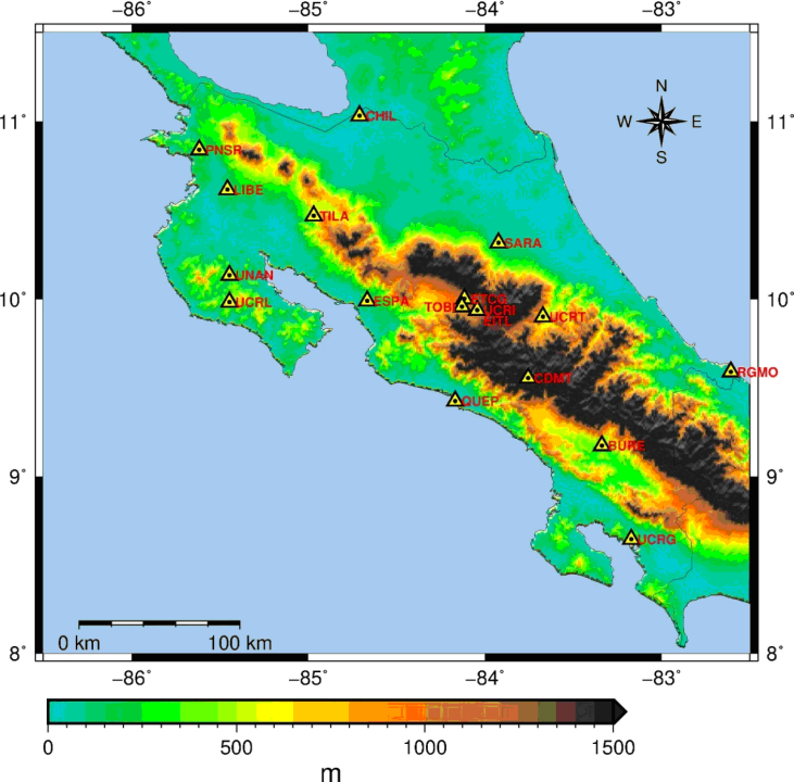
University of São Paulo, Polythecnic School, Department of Engineering Transportation (EPUSP-PTR) supported by Institute of Geography and Cartography (IGC) of São Paulo and Centro de Estudos de Geodesia (CENEGEO) and the University of Costa Rica, Faculty of Surveying Engineering and Instituto Geográfico Nacional (IGN), Costa Rica, cooperated for the establishment of the Absolute Gravity Network in the country. A total of 18 stations have been observed. The measurements have been undertaken with A-10 Micro-g LaCoste absolute gravitymeter, number 032. The stations are identified by the name of the city as follow: San José (UCR), Pavas (TOBI), San José (EITL), Heredia (GTCG), Cerro Buenavista (CDMT), Buenos Aires (BURE), Golfito (UCRG), Quepos (QUEP), Esparza (ESPA), Nicoya (UNAN), Liberia (LIBE), Santa Rosa (PNSR), Tilarán (TILA), Los Chiles (CHIL), Turialba (UCRT), Limon (UCRL), Sarapiqui (SARA), Gandoca (RGMO). The figure shows the distribution of the stations in the country. The final results are under analysis and they will be published very soon. But, it is already known that the Standard Deviation (S.D.) of the network, in most of the stations, are between 10 to 12 µGal. This network will be a contribution for the International Global Absolute Reference Frame (IAGRF). The following people participated to the efforts for the measurements: Denizar Blitzkow and Ana Cristina O. Cancoro de Matos from CENEGEO; Iuri Bjorkstrom and Valéria Cristina Silva, from University of São Paulo; Oscar H. Lucke, Juan Antonio Picado Salvatierra, Jaime Garbanzo Leon, Alonso Vega Fernandez from University of Costa Rica, Álvaro Álvarez Calderón from the National Geographical Institute of Costa Rica.
In the past two important efforts have been experienced in Costa Rica. In the first case, IGSN71 efforts set up two gravity reference stations. One of the sites was located in the Central Park of the capital city of San José. The other site was placed in the coastal city of Puntarenas. This last one is important since it is near the site of the tide gauge used to establish the mean sea level, which was a height reference for the original geodetic network of Costa Rica.
After IGSN71, the geophysics commission of the Pan-American Institute for Geography and History formed a group called the Latin-American Gravity Informative System (known as SILAG for its initials in Spanish) with support of the Inter-American Geodetic Survey (IAGS), at that time. This group, with support of the individual geographical institutes of the nations involved, implemented a project called Latin-American Network for the Normalization of Gravity 1977 (known as RELANG77 for its initials in Spanish). This project created a network of gravity reference stations through relative gravity observations based on the IGSN71 values. For Costa Rica, RELANG created eight gravity reference stations.
Moreover, Costa Rica is located within a highly dynamic region regarding tectonics and volcanism. This means that the gravity value might change over time due to vertical deformation of the surface caused by crustal faults and subduction processes and due to changes in the internal mass distribution caused by magmatic processes. So, the present absolute network will be very important for gravity changes monitoring, between other applications.
DENIZAR BLITZKOW
ANA CRISTINA O. CANCORO DE MATOS
Honorary volume of Athanasios Dermanis
 A Honorary volume for Professor Emeritus Athanasios Dermanis has been published by the School of Rural and Surveying Engineering of the Aristotle Universsity of Thessaloniki:
Fotiou A., D. Rossikopoulos, eds. (2018): “Quod erat demonstrandum. In quest for the ultimate geodetic insight.” Special issue for Professor Emeritus Athanasios Dermanis. Publication of the School of Rural and Surveying Engineering, Aristotle Universsity of Thessaloniki, 405 pages. ISBN 978-960-89704-4-1.
The volume includes contributions from Erik Grafarend, Fernando Sansò, Peter Teunissen, Zuheir Altamimi, Lars Sjöberg, and many others. Individual contributions are available at: https://www.topo.auth.gr/el/honoraries-dermanis The whole volume is also available in electronic form. For requests contact: Prof. Dr. Dimitrios Rossikopoulos (Email: rossi@topo.auth.gr)
Table of Contents
E. Grafarend: The Global World of A. Dermanis and an attempt to use System Dynamics for the analysis of Polar Motion (POM) and Length of Day Variations (LOD).
Fernando Sansò: Helmert’s Transform by Quaternions. A Revisitation.
P.J G. Teunissen: Unbiased Estimation + Testing = Biased Estimation.
A. Fotiou: A Discussion on Least Squares Adjustment with Worked Examples.
D.A. Rossikopoulos: Residual Analysis and Detection of Outliers in Mixed Linear Models.
X. Collilieux, Z. Altamimi, P. Rebischung, L. Métivier: Coordinate Kinematic models in the International Terrestrial Reference Frame releases.
C. Kotsakis: Datum Singularity in TRF Estimation: Diagnostic Tools and Rank-Deficient NEQ Reconstruction.
B. Benciolini, D. Sguerso, A. Vitti, P. Zatelli: New Procedures for the Adjustment of Photogrammetric Blocks.
L.E. Sjöberg: The Temporal Change of the Geoid Determined from GRACE monthly sets of data.
R. Barzaghi, B. Betti: GNSS Permanent Station Data Analysis in Crustal Deformation Studies.
A. Fotiou, C. Pikridas, D. Rossikopoulos, S. Bitharis: Estimation of Velocity Field using seven years GNSS permanent station data. Application to Hellenic area.
F. Fratarcangeli, G. Savastano, G. Pietrantonio, M.C. D’Achille, A. Mazzoni, F. Riguzzi, R. Devoti, M. Crespi: Static vs Real-Time Coseismic Offset Comparison: The Test Case of 30 October, 2016 Central Italy Earthquake.
D. Ampatzidis: Is really the “Local Datum” an Obsolete and Old-Fashioned Definition? The catalytic role of the velocity field for the modern geodetic reference frames: The Minimum Kinetic Energy Criterion.
D.-V. Psychas, D. Delikaraoglou: Precise Point Positioning in a New GNSS Era.
M. Kaselimi, D. Delikaraoglou: Estimating the Prospects of Wave Energy Potential in Eastern Mediterranean using Multi-mission Satellite Altimeter Data.
D.A. Natsiopoulos, G.S. Vergos, I.N. Tziavos: Modeling the Barotropic Response of the Mediterranean Sea Level to Atmospheric Pressure Forcing.
M.E. Contadakis, D. Arabelos: Mid Latitude TEC Variations before and during the Balkan Peninsula Seismic Activity of 24th May 2009.
G. Panou, R. Korakitis, D. Delikaraoglou: Cartesian to Geodetic Coordinates Conversion by an Iterative Geometrical Method.
A.E. Foscolos: The Messinian Salinity Crisis during the Upper Miocene as a Cause for Generating Giant and Super-Giant Biogenic Gas Fields in the Eastern Mediterranean Basin.
B. Betti, L. Biagi, M. Brovelli: The Geoinformatics Engineer and the new MSc in Politecnico di Milano.
A. Ktistis, P. Tokmakidis, K. Papadimitriou, K. Tokmakidis: Surveying, Modeling and 3D Representation of a Wreck for Diving Purposes: Cargo ship “Vera”.
I. Fotiou: An Introduction to Tropical Convexity.
M. Papadopoulou, P. Tziachri, P. Lafazani, F. Papadopoulos, I. Metaxa: Using Spatial Analysis in a GIS Environment, for the Exploration of Soil and Corresponding Leaf Chemical Components. An Application in Apple Trees of Kastoria Region, Greece.
I. Pontikas, D. Pekalis, O. Georgoula, P. Patias, D. Kaimaris: Coastal mapping with the use of unmanned aerial vehicles.
A. Fylaktakis, S. Basbas, G. Mintsis, Ch. Taxiltaris, A. Tsoukala: The catalytic role of practical training in road safety education.
S. Yannopoulos, I. Giannopoulou, M. Kaiafa-Saropoulou: Rainwater Harvesting (RWH) as an alternative source to confront water scarcity worldwide – Current situation and Perspectives.
D. ROSSIKOPOULOS
Advances in Space Research – promotional OpenAccess
Dear colleagues,
for your information, issue 63(1) of Advances in Space Research (COSPAR official journal), published on January 1, 2019, is available online and will remain free-of-charge without any paid subscription to this journal for a complete year, courtesy of Elsevier, providing promotional OpenAccess.
All articles can be accessed at:
https://www.sciencedirect.com/journal/advances-in-space-research/vol/63/issue/1
While it is a very large issue (59 papers and 812 pages), the selected article below could be of interest to the Laser community:
EARTH SCIENCES
Akihisa Hattori, Toshimichi Otsubo Conklin (2019) Time-varying Solar Radiation Pressure on Ajisai in Comparison with LAGEOS Satellites, Advances in Space Research, 63(1), 63-72, DOI: 10.1016/j.asr.2018.08.010
ASTRODYNAMICS AND SPACE DEBRIS
Dariusz Strugarek, Krzysztof Sośnica and Adrian Jäggi Conklin (2019) Characteristics of GOCE Orbits Based on Satellite Laser Ranging, Advances in Space Research, 63(1), 417-431, DOI: 10.1016/j.asr.2018.08.033
Best regards
PASCAL WILLIS
ASR Editor-in-chief
Meeting Announcements
Meetings Calendar
IAG Sponsored Meetings
24th Meeting of the European VLBI Group for Geodesy and Astronomy (EVGA) and 18th IVS Analysis Workshop
March 14 – 20, 2019, Las Palmas, Gran Canaria, Spain
URL: http://www.oan.es/evga2019/
3rd IVS Training School on VLBI for Geodesy and Astrometry
March 14-16, 2019, Las Palmas de Gran Canaria, Spain
URL: http://wp.portal.chalmers.se/evga/vlbi-school-2019/
4th Joint International Symposium on Deformation Monitoring (JISDM)
May 15 – 17, 2019, Athens, Greece
URL: http://jisdm2019.survey.ntua.gr/
EUREF Symposium 2019
May 22 – 24, 2019, Tallinn, Estonia
URL: http://www.maaamet.ee/euref2019/
27th IUGG General Assembly
July 8 – 17, 2019, Montreal, Canada
URL: http://www.iugg.org/assemblies/
Munich Remote Sensing Symposium 2019 (MRSS19)
September 18 – 20, 2019, Munich, Germany
URL: www.pf.bgu.tum.de/isprs/mrss19/index.html
5th IAG Symposium on Terrestrial Gravimetry: Static and Mobile Measurements
October 1 – 4, 2019, Saint Petersburg, Russia
URL: http://www.elektropribor.spb.ru/tgsmm2019/eindex
2019 ILRS Technical Workshop
October 21 – 25, 2019, Stuttgart, Germany
URL: https://ilrs.cddis.eosdis.nasa.gov/about/meetings.html
IAG Related Meetings
Workshop on 'Global Navigation Satellite System (GNSS)'
March 9, 2019, Delhi, India
URL: http://aprasc2019.com/global-navigation-satellite-system-gnss/
Munich Satellite Navigation Summit 2019
March 25-27, 2019, Munich, Germany
URL: https://www.munich-satellite-navigation-summit.org/
2nd ISSI Workshop "Spacetime Metrology, Clocks and Relativistic Geodesy"
March 25-29, 2019, Bern, Switzerland
URL: http://www.issibern.ch/teams/spacetimemetrology/index.php/schedule-meetings/
EGU General Assembly 2019
April 7-12 , 2019, Vienna, Austria
URL: http://www.egu2019.eu/
ION Pacific Positioning, Navigation and Timing (PNT) Conference
April 8-11 , 2019, Honolulu, Hawaii, USA
URL: https://www.ion.org/pnt/
IGS 2019 Analysis Workshop
April 15-17, 2019, Potsdam, Germany
URL: http://www.igs.org/events
ESA Living Planet Symposium
May 13-17 , 2019, Milan, Italy
URL: https://lps19.esa.int
Arctic Science Summit Week 2019
May 22-30 , 2019, Arkhangelsk ,Russia
URL: https://www.en.assw2019.science/
AOGS 16th Annual Meeting
July 28 – August 2, 2019, Singapore, Singapore
URL: http://www.asiaoceania.org/society/public.asp?view=up_coming
Earth & Geo Science-2019
August 12-13, 2019, Prague, Czech Republic
URL: https://scientificfederation.com/earth-science-2019/
First International School on “Geoid Modelling, Gravity Inversion and its Applications”
September 9-13, 2019, Gävle, Sweden
URL: https://www.hig.se/4.6c77c68166435adf0b3d060.html
4th Symposium of the Committee on Space Research (COSPAR)
November 4-8, 2019, Herzliya, Israel
URL: http://www.cospar2019.org/
Reports
21st International Workshop on Laser Ranging – Workshop Summary
The Space Environment Research Centre (SERC) and the ILRS hosted the 21st International Workshop on Laser Ranging at the John Curtin School of Medical Research, Australian National University in Canberra, Australia during the week of November 05-08, 2018. SERC was established to combine government, university, and industry resources to apply new optical technology toward the problem of space debris, including information and direct intervention. Their research supports improvements in debris orbit predictions that allow active satellites to maneuver in time to avoid space debris collision. As such, SERC is, in general, very interested in laser ranging.
The theme of the workshop “Laser Ranging for Sustainable Millimeter Geoscience” afforded presentations on a wide range of topics highlighting SLR contributions to research. The workshop consisted of nine oral sessions with posters for each session. The session topics were:
- SLR Contribution to Global Geodetic Observing System – A 2020 Perspective
- Improvements in the SLR Product Quality and Precise Orbit Determination
- Satellite Missions and Techniques for Geodetic Applications
- Characteristics of Retroreflector Arrays
- Sources of Systematic Errors
- Network Operations and Site Upgrades
- Developments in SLR Techniques and Technologies
- Developments in Software and Automation
- Lunar Laser Ranging and Deep Space Missions
In addition to the main oral sessions, the workshop dedicated significant program time to poster sessions. Poster submissions were requested for each session theme. Furthermore, posters which provided updates on station activities were strongly encouraged. The workshop once again included a station operations or “clinic” session where ILRS experts met in small groups of station engineers and operators to provide solutions to common station problems, information to maintain station stability, and guidelines for interacting with the analysts in determining station biases. These station clinics were well received and attended by workshop participants.
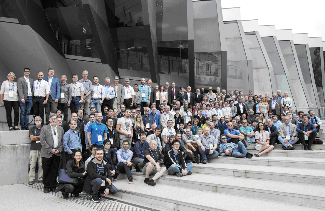
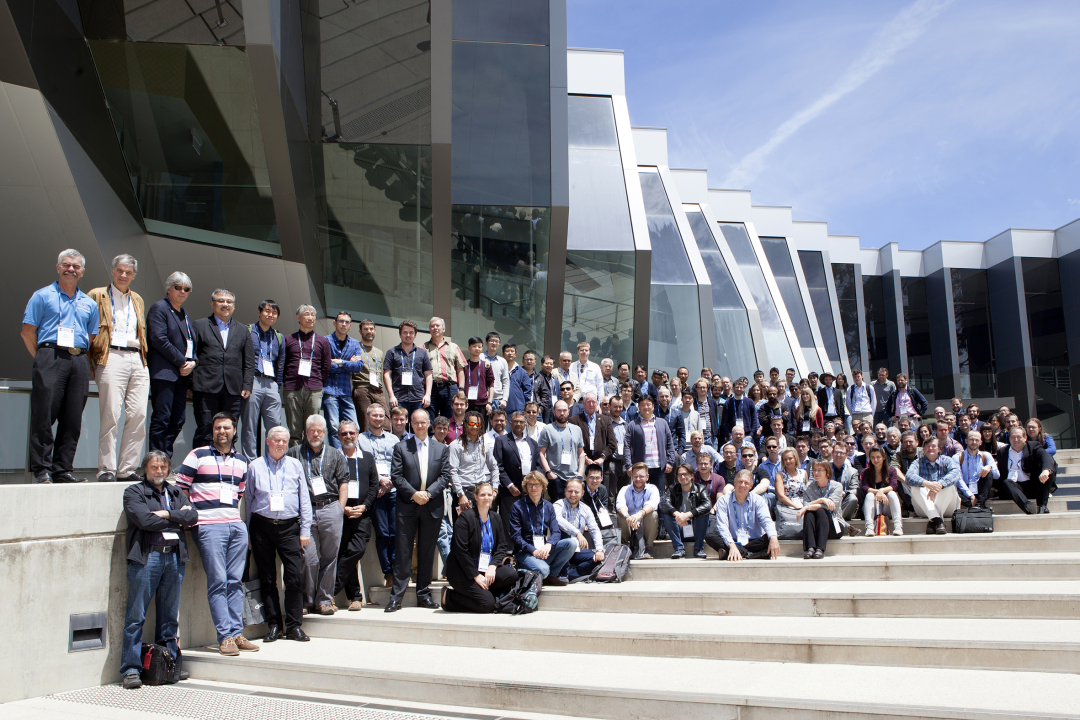
Over 175 registrants from 23 countries participated in the four-day laser ranging workshop. It was followed by a one-day International Workshop on Space Debris Management on November 09; 20 additional attendees, mainly from Australia, participated.
The workshop program included 80 oral presentations and over 60 posters; 25 oral presentations and 15 posters were given at the Space Debris Workshop. All abstracts, presentations, posters, and summary papers from both workshops are available within the Program section of the workshop’s proceedings website: https://cddis.nasa.gov. Additional information, such as meeting summaries, photos, and the full program booklet are available through this website.
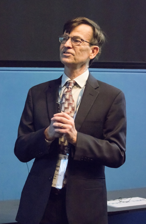 Professor Thomas Herring, Massachusetts Institute of Technology, Cambridge, MA gave the invited keynote talk to open the workshop. Professor Herring’s presentation highlighted the important synergy of SLR with the other space geodesy techniques, and ways of drawing out small systematic issues through careful scrutiny of the SLR data.
The four-day workshop program was organized into nine oral sessions, and two poster sessions focused on the oral session topics. A brief summary of these sessions:
- Session 1, “SLR Contribution to the Global Geodetic Observing System – A 2020 Perspective” covered SLR contributions to GGOS and inter-technique comparisons and synergies between SLR and other space geodetic techniques including the role of local ground surveys.
- Session 2, “Improvements in the SLR Product Quality and Precise Orbit Determination” dealt with estimation and monitoring of systematic errors, improved center of mass correction on geodetic satellites, advances in geophysical modeling, SLR synergy with GNSS, and SLR improvements in the terrestrial reference frame.
- Session 3, “Satellite Missions and Techniques for Geodetic Applications” discussed some of today`s many SLR applications including: validation and QC support for GNSS, spacecraft engineering tests, laser time transfer, spacecraft attitude determination, reflector panel resolution performance, new methods of gravity field estimation, and new application through the use of constellations of nano-satellites.
- Session 4, “Network Operations and Site Upgrades” included plans for new stations, upgrades and new technology at existing stations, overall network performance, and review of updates to ILRS procedures.
- Session 5, “Sources of Systematic Errors”, stressed the challenge of the 1-mm accuracy for GGOS and demonstrated that the identification and characterization of system biases now underway, is an essential step toward achieving this goal; some new analytic and modeling techniques for reducing range biases and the introduction of automated processing with data discrimination procedures are already being implemented at some stations.
- Session 6, “Characteristics of Retroreflector Arrays”, reviewed new developments in retroreflector arrays, including new targets already being tracked and those in planning or testing for future missions, including new compact retroreflector arrays that will reduce ranging RMS.
- Session 7, “Development of Software and Automation”, discussed the move toward fuller automation, including software development in scheduling, visualization, data processing, and station performance assessment.
- Session 8, “Developments in SLR Techniques and Technologies”, focused on new technologies to improve performance, and help standardize and simplify SLR/LLR systems, and potentially reduce systems costs, and the use of existing technologies for new SLR applications such as laser communication and space debris monitoring.
- Session 9, “Lunar Laser Ranging and Deep Space Missions”, reviewed recent progress in Lunar Laser Ranging and lunar reflector technology; interest is growing in lunar ranging and the science resulting from these measurements with more stations being planned.
Workshop organizers allocated one afternoon during the week to station “clinics”, allowing station operations staff (and anyone else with interest in the topics covered) to meet in small groups with experts in the engineering and data analysis areas. The clinics primarily benefited station representatives although others attendees were encouraged to participate. The topics covered in the clinic sessions were:
- Data quality
- Data productivity
- System accuracy/biases
- ILRS procedures
- Web tools and software
- Calibration and ground targets
These sessions were intended to be two-way conversations between topic experts and station contacts; material was prepared and distributed prior to the workshop to allow these representatives to gather any questions prior to the workshop. Six small group clinics provided solutions to common station problems, information on maintaining station configuration stability, overview of new tools available, and guidelines for interacting with the analysts in determining station biases.
One issue that stimulated discussion was the SLR policy in tracking GNSS satellites. The ILRS routinely prioritizes satellite targets by altitude (LEO through geosynchronous), with occasional adjustments to enhance tracking on new satellites, typically with active systems aboard. Within the GNSS regime, several satellites may be given high priority at the request of the constellations to provide better pass coverage (3 pass segments) for special directed applications. Of the remaining GNSS satellites (currently ~ 60), a subset is identified for non-prioritized tracking on “as time permits” basis. The ILRS will work with the IGS and the contacts from the GNSS constellations for their inputs.
The 21st International Workshop on Laser Ranging concluded with a general discussion on the format of the workshop, planning for future workshops, and improvements to the clinic content and organization. In addition, the attendees put forth several resolutions:
The IGS:
- Requests that ILRS instruct stations to track the non-prioritized GNSS satellites in a low density (1 pass segment), randomized manner, where each station can freely select a set of GNSS satellites for tracking on a weekly basis, and in that way, get an orbital sampling of many GNSS satellites.
- Requests that the remaining GNSS satellites be left in a randomized tracking pool;
- Encourages development/installation of SLR stations in the Asia-Pacific region and the transition to kHz laser systems thus enabling shorter normal point duration.
The ILRS:
- Suggests that GNSS satellite tracking would be helped by giving stations some general selection criteria to encourage a satellite mix;
- Suggests that relegating all the remaining GNSS satellites (~60 ) to a lower active tracking priority might lead to very sparse coverage, and that it might be wise to reduce this pool to ~30 well-selected satellites to avoid an imbalance of tracking among the constellations and to recognize the difference in day-night visibilities.
- The participants acknowledged the great success of the 21st International Workshop on Laser Ranging and thanked SERC and the local organizers for their exhaustive efforts and meticulous organization that enabled this successful workshop.
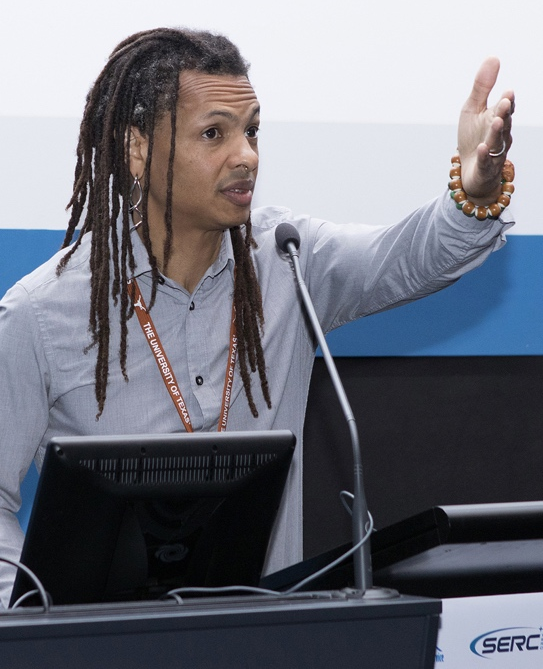 Dr. Moriba Jah gave the keynote presentation “Towards Quantifiable Resident Space Object Activity and Behavior Prediction, Identification, Quantification, and Assessment” for the International Workshop on Space Debris Management (Photo credit: Exclusive Images, Canberra, Australia)
The last day of the week was devoted to a separate event, the International Workshop on Space Debris Management, which has synergy with new ILRS applications. Associate Professor Moriba Jah, University of Texas at Austin gave the opening keynote presentation to the International Workshop on Space Debris Management. This interesting talk covered the global importance of developing a capability to predict, quantify, and assess the behavior of objects in space and ideas for identification, location prediction/modeling, and quantification of space objects.
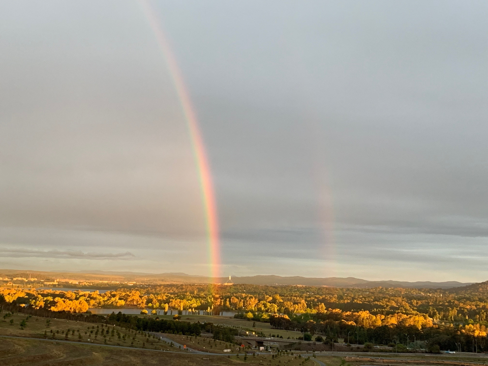
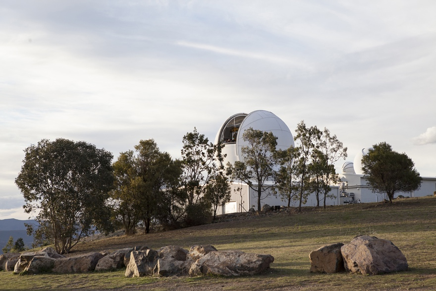
The workshop’s local organizing committee not only assisted in the preparation of an excellent program, but handled all logistics at the venue and arranged several excellent social events. The Wednesday workshop banquet took place at the National Arboretum, surrounded by forests of rare and endangered trees from not only Australia but around the world; attendees explored the grounds and were treated to a beautiful landscape complete with double rainbow. On the final day of the week, participants were given a tour of the EOS Space Research Centre (including the telescope facility) at Mt. Stromlo, which consists of operational and lab facilities for SLR and space debris tracking. The site also includes a state-of-the-art ground survey monitoring system with some locally built survey/ground baseline monitoring hardware. The local hosts concluded the tour with a barbeque dinner on the grounds of Mt. Stromlo with local kangaroos in attendance.
Once again, this International Workshop on Laser Ranging was another successful assembly of experts in the global laser ranging scientific community. The community looks forward to the next opportunity to meet, the 22nd International Workshop on Laser Ranging, which is planned for the 2020 timeframe in Kunming China.
MIKE PEARLMAN
CAREY NOLL
ILRS Central Bureau
| DOCUMENTS |
| IAG_Newsletter_February_2019.pdf |