December 2022

General Announcements
- IUGG General Assembly Berlin 2023
- Improved cross-border height determination in the European Alps – The "European Alps Geoid Project (EAlpG)"
- Highlights: Spatial Gravimetry and Quantum Gravimetry
- Meeting G2 (Geodesy-Geophysics) 2022 November 8-10
- Report on 2022 SIRGAS Symposium and Vertical Reference System Workshop
Meetings Calendar
IAG Sponsored Meetings
- EUREF Symposium 2023
- IUGG Berlin 2023
- GGOS Days 2023
- ILRS Technical Workshop 2023
Geodesy Related Meetings
- Munich Satellite Navigation Summit 2023
- European Navigation Conference 2023
- FIG Working Week 2023
- Bologna-VLBI: Life begins at 40!
- AOGS 20th Annual Meeting
- 13th Session of UN GGIM
General Announcements
IUGG Berlin 2023
The 28th IUGG General Assembly (IUGG2023) will be held from 11 to 20 July 2023 at the CityCube in Berlin, Germany.
This General Assembly is a special opportunity for participants from around the world to come together and discuss the full range of geodetic and geophysical themes, and further enhance the important interdisciplinary collaboration for a better understanding of our Earth System. IUGG2023 will provide a platform for personal meetings, exchange of ideas and developing new concepts for international science collaboration, all of which have suffered a setback during this pandemic crisis. IUGG2023 will help to create a new spirit to address pressing large societal challenges such as global environmental change and natural hazards and to stimulate novel geoscience research.
Important Dates
14 February 2023
- Abstract submission deadline
- Closing of grant application submission
17 March 2023
- Abstract/grant acceptance sent to participants
11 April 2023
- Complete scientific program and guidelines for presenters published
28 April 2023
- Early-bird registration closes
02 May 2023
- Newsletter on field trips and accommodation reservations
- Final Adjustment of program
IUGG2023 Local Organizing Committee and Scientific Program Committee
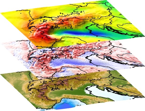
Improved cross-border height determination in the European Alps – The "European Alps Geoid Project (EAlpG)"
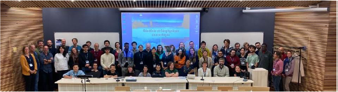
On September 29 and 30, 2022, delegates and geoid experts from the Alpine and neighboring countries convened in Vienna and online to bring forward the "European Alps Geoid" project. The hybrid meeting was hosted in Vienna, Austria, by the Federal Office of Metrology and Surveying (BEV).
The "European Alps Geoid Project" (EAlpG) aims at harmonizing the basis for height determination in the German-speaking Alpine region, including the neighboring lowlands. This means that the “European Alps Geoid” also includes parts of Hungary, Slovakia and the Czech Republic. It is a joint initiative of the national bodies responsible for or involved in the integrated geodetic spatial reference:
- Federal Office of Metrology and Surveying (BEV, Austria)
- Federal Office of Topography (swisstopo, Switzerland)
- Federal Acency for Cartography and Geodesy (BKG, Germany)
- State Office for Geoinformation and Rural Development (LGL, Germany/Baden-Wuerttemberg)
- Agency for Digitisation, High-Speed Internet and Surveying (LDBV, Germany/Bavaria)
- National Institute of Geographic and Forest Information (IGN, France)
- Politecnico di Milano (Polimi, Italy)
- Cadastre of South Tyrol (Italy)
- Surveying and Mapping Authority (SMA, Slovenia)
- Geodetic and Cartographic Institute Bratislava (GKÚ, Slovak Republic)
- Slovak University of Technology in Bratislava (STU, Slovak Republic)
- Comenius University Bratislava (Slovak Republic)
- Slovak Academy of Sciences (SAS, Slovak Republic)
- Space Geodetic Observatory (SGO) c/o Lechner (LTK, Hungary)
- Land Survey Office (ZÚ, Czech Republic)
The EAlpG group is complemented by associated members from the scientific community:
- Graz University of Technology (TU Graz, Austria)
- Technical University of Munich (TUM, Germany)
- University of Ljubljana (Slovenia)
The Memorandum of Understanding was concluded on May 12, 2022, with the goal to promote the cooperation in the field of regional gravity field modeling, to exchange and improve the underlying data and models, and to facilitate cross-border height determination for users of geodetic coordinates. To this end, the following activities are planned:
1. Improved cross-border regional geoid model of the Alpine area
- Exchange and revision of the base data for the calculation of the geoid models: gravity data, digital elevation models, control points for validation
- Comparative studies on geoid modeling in high mountains
2. Improved height transformation between the Alpine countries
- Extensive comparative investigations and validation between the national height reference surfaces (geoid models and other height transformation grids) and the national and European heights along the borders
- Derivation of a consistent height transformation model accurate to a few centimeters
- Development of a corresponding web application
These works can build on the first experiences and findings gained within the previous “D-A-CH geoid” project, covering a test area around Lake Constance. It was a joint initiative of the federal and state authorities responsible for land surveying in Germany, Austria and Switzerland (BEV, swisstopo, BKG, LGL and LDBV). Achievements of this phase were presented at EGU2021 (Schwabe et al. 2021, https://doi.org/10.5194/egusphere-egu21-7567).
The activities are embedded in a pan-European initiative for a European Height Reference Surface within the framework of EUREF, the scientific sub-commission for Europe within the IAG. As a contribution to the EUREF Working Group "European Unified Height Reference”, the EAlpG will be one of many cornerstones for the first official realization of a unified European height reference surface connected to EVRS and ETRS89. The metadata about the national height reference frames and transformation products will also be used to modernize the information system for the European coordinate reference systems CRS-EU (http://www.crs-geo.eu). Another synergy arises from the fact that some of the new EAlpG members are also involved in the geophysical project AlpArray, providing a modernized Bouguer gravity map of the Alpine region (Zahorec et al. 2021, https://doi.org/10.5194/essd-13-2165-2021).
The meeting included status reports on development of the United European Leveling Network (UELN) as well as the national geodetic base data relevant for gravity, geoid and height determination. Ideas for joint geodetic fieldwork, e.g. to improve cross-border leveling connections or to create a local high-mountain test bed for geoid modeling, were discussed. Finally, special aspects of geoid modeling and validation were discussed in detail.
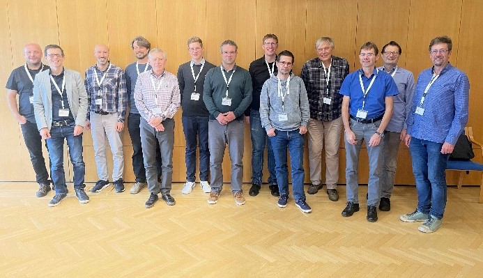
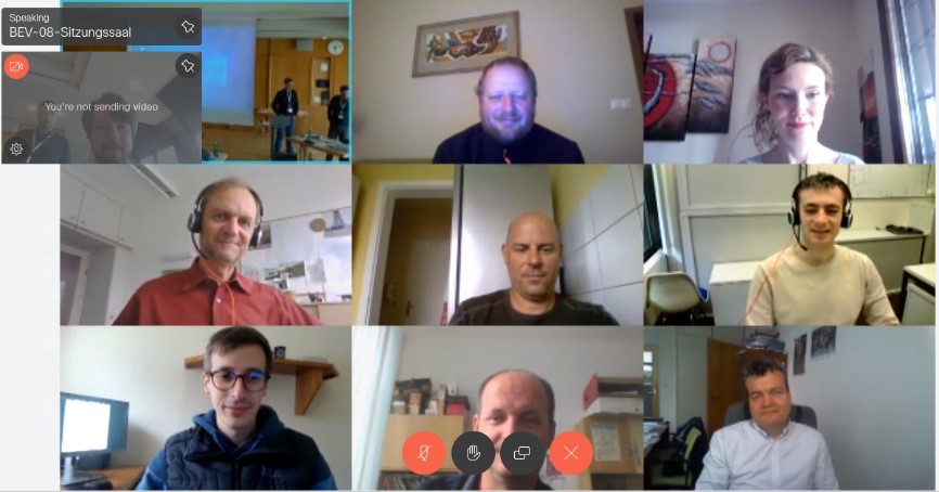
Participants of the meeting
More information can be found on the provisional website:
https://bkg.bund.de/EN/About-BKG/Geodesy/Information-systems-and-Projects/EN_DACH_EAlpG_Details.html
Joachim Schwabe
Federal Agency for Cartography and Geodesy
e-mail: joachim.schwabe@bkg.bund.de
Highlights: Spatial Gravimetry and Quantum Gravimetry
A new method to identify pre-seismic mass anomalies in GRACE gravity solutions has been developed by I Panet and colleagues (University of Paris, IPGP and IGN; Panet 2018, 2022 https://doi.org/10.1029/2018JB016717; https://doi.org/10.1029/2022JB024542).
Their approach is based on the computation of gravity gradients. They first detected a dipole gravity gradient anomaly before the 2011 Mw9.0 earthquake in Tohoku. They also revealed a large-amplitude gravity gradient signal, which gradually increased during the three months preceding the 2010 Mw8.8 earthquake in Maule-Chile (Bouih et al. 2022, https://doi.org/10.1016/j.epsl.2022.117465). Both of these results emphasize the importance of observing the Earth's time-varying gravitational field from satellites in order to probe the slow mass redistributions at the depth of major plate boundaries. Such studies provide new information on the dynamic processes of the subduction system, essential to better understand the overall seismic cycle.
Airborne quantum gravity, after the marine version, has been developed, tested and validated by a Y Bidel and colleagues including Shom, IRD, Onera, OMP, DTU and the Bureau Gravimétrique International (Bidel et al., 2018, 2022, https://doi.org/10.48550/arXiv.2210.07865; 2018, https://doi.org/10.1038/s41467-018-03040-2). This technique has allowed to resolve scientific limitations for the realization of absolute gravimetric measurements in very bad conditions (strong parasitic accelerations).
Marie-Françoise Lequentrec-Lalancette
Meeting G2 (Geodesy-Geophysics) 2022 November 8-10
In order to bring together geodesists and geophysicists on related topics, the French G2 (Geodesy-Geophysics) community organized the annual conference to allow exchanges between scientists, young researchers and Ph-D students. This year, the conference was organized in Grenoble in November on the issue "Geodesy, Geophysics and Mountains". Topics was related to the study of telluric hazards in mountain areas (seismic, volcanic, gravity), the cryosphere, and the study of deformation processes and geodynamics of mountain ranges.
Marie-Françoise Lequentrec-Lalancette
Report on 2022 SIRGAS Symposium and Vertical Reference System Workshop
The 2022 SIRGAS Symposium was held between November 7th to 9th, 2022, in Santiago, Chile as hybrid mode. Following the new SIRGAS events´ regulation, this symposium had a simultaneous translation service between the English and Spanish languages, during the technical sessions and the SIRGAS Working Groups meetings.
The organization of the 2022 SIRGAS Symposium was under the coordination of the SIRGAS Executive Committee and the Local Organizing Committee, the Instituto Geográfico Militar (IGM) of Chile. As on previous occasions, it had the valuable support of the International Association of Geodesy (IAG) and the Pan-American Institute of Geography and History (PAIGH).
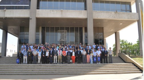 Participants of the SIRGAS 2022 Symposium, IGM-Chile, Santiago, Chile, November 7th to 9th, 2022
The technical sessions of the symposium had the contribution of 59 presentations from the following countries: Germany, Argentina, Canada, United States, Costa Rica, Colombia, Brazil, Ecuador, Bolivia, Chile and Uruguay. There was an attendance average of 90 participants onsite and 130 as remote.
All Symposium presentations´ are available at https://app.ign.gob.pe/simposio/programacion/.
Five technical sessions were held during these three days and main topics addressed were:
- Session 1: Report of the SIRGAS authorities: President of SIRGAS, Presidents of the SIRGAS Working Groups and update of the GRFA of UN-GGIM: Americas;
- Session 2: Development and maintenance of the SIRGAS reference framework;
- Session 3: Modeling of the Earth's gravity field (geoid, gravimetry, international reference system of heights).
- Session 4: Applications of the SIRGAS framework (national reports, real-time applications, etc.).
- Session 5: SIRGAS contributions to the modeling of the Earth System (troposphere, ionosphere, seismology, oceanography and hydrography).
The next symposium will be in 2024 and will be held in the city of Bogotá, sponsored by the Agustín Codazzi Geographic Institute.
Vertical Reference System Workshop
In the previous week, from November 2nd to 4th, the Vertical Reference System Workshop was held. This workshop was coordinated with the Instituto Geográfico Militar of Chile at the facilities of the Bernardo O'Higgins University and had as instructors Dr. Gabriel do Nascimento Guimarães (Federal University of Uberlândia) and Hernán Javier Guagni from the National Geographic Institute of Argentina. Fourteen 14 professionals from 7 countries have participated.
The main objective of the workshop was to contribute to the training process of researchers, professionals, and technicians from the Americas who participate in the investigation, definition, and updating of national vertical reference frames and systems based on the processing of gravimetric and spirit leveling data. Subjects related to the unification of the vertical datum, according to the guidelines and actions directed towards to the materialization of the IHRS (International Height Reference System) were explored.
Sonia Costa
Meetings Calendar
IAG Sponsored Meetings
- 2nd Workshop of Inter-Commission Committee on Geodesy for Climate Research (ICCC), March 28 – 30, 2023, online
URL: https://iccc.iag-aig.org/iccc-workshops/ws23 - EUREF Symposium 2023, May 22-26, 2023, Gothenburg, Sweden
URL: http://www.euref.eu/euref_symposia.html - IUGG Berlin 2023, July 11-20, 2023, Berlin Germany
URL: https://www.iugg2023berlin.org - GGOS Days 2023, September 20–22, 2023, Yebes, Spain
URL: https://ggos.org/event/ggos-days-2023/ - ILRS Technical Workshop 2023, October 16– 20, 2023, Arequipa, Peru
URL: https://ilrs.gsfc.nasa.gov/about/meetings.html
Geodesy Related Meetings
- Munich Satellite Navigation Summit 2023, March 13 – 15, 2023, Munich, Germany
URL: https://www.munich-satellite-navigation-summit.org/ - European Navigation Conference 2023, May 31-June 2, ESA ESTEC, Noordwijk, The Netherlands
URL: https://www.enc2023.eu - FIG Working Week, May 28 - June 1, Orlando, FL, USA
URL: https://www.fig.net/fig2023/ - Bologna-VLBI: Life begins at 40!, May 22-26, Bologna, Italy
URL: https://vlbi-40.ira.inaf.it/ - AOGS 20th Annual Meeting, July 30 - August 4, Singapore
URL: https://www.asiaoceania.org/aogs2023/ - 13th Session of UN GGIM, August 2-4, New York City, USA
URL: https://unstats.un.org/UNSDWebsite/events/
Further details are available in the IAG Event Calendar at: http://www.iag-aig.org/events.
The IAG Newsletter is under the editorial responsibility of the Communication and Outreach Branch (COB) of the IAG. It is an open forum and contributors are welcome to send material (preferably in electronic form) to the IAG COB (newsletter@iag-aig.org). These contributions should complement information sent by IAG officials or by IAG symposia organizers (reports and announcements). The IAG Newsletter is published monthly. It is available in different formats from the IAG new internet site: http://www.iag-aig.org.
Each IAG Newsletter includes several of the following topics:
- news from the Bureau Members
- general information
- reports of IAG symposia
- reports by commissions, special commissions or study groups
- symposia announcements
- book reviews
- fast bibliography
| DOCUMENTS |
| IAG_Newsletter_December_2022.pdf |