February 2022

General Announcement
- IAG Statement on Ukraine
- Discover GGOS
Meetings Calendar
IAG Sponsored Meetings
- IGRF Workshop 2022
- EUREF 2022 Symposium
- Spatial Data: science, research and technology 2022
- X Hotine-Marussi Symposium on Mathematical Geodesy
- IGS Workshop "IGS 2022: Science from Earth to Space"
- 2nd International Symposium of Commission 4: Positioning and Applications
- Gravity, Geoid and Height Systems 2022 (GGHS2022)
- REFAG 2022
- Unified Analysis Workshop on Laser Ranging
- 22nd International Workshop on Laser Ranging
- 20th Assembly of WEGENER
- GGOS Days 2022
IAG Related Meetings
- COSPAR 2022
Book Review
- Mission Earth - Geodynamics and Climate Change Observed Through Satellite Geodesy
Obituary
- George Veis (1929-2022)
General Announcements
IAG Statement on Ukraine
The International Association of Geodesy and its services strongly condemn the unprovoked and premeditated Russian invasion of Ukraine. We are deeply troubled by the loss of life and hundreds of thousands of civilians becoming refugees, and are very concerned about the safety and well-being of our scientific colleagues in Ukraine. We strongly request that the responsible people stop the military actions immediately.
For the past 150 years, the International Association of Geodesy has been an enduring and politically neutral forum for dialogue and collaboration for geodetic scientists and engineers around the world, through its various research bodies and technical services. IAG aligns with the recent statement of the International Science Council, which “warns against the severe outcomes that conflict will have on the research and academic community. Our capacity to work collaboratively on global challenges, and on cutting edge research such as Arctic and space research, is only equal to our capacity to maintain strong collaboration amidst geopolitical turmoil. Ultimately the isolation and exclusion of important scientific communities is detrimental to all.”
IAG is committed to continue advancing the equal participation and collaboration among geodesists of all peaceful nations, towards the development of geodetic applications and innovations for the benefit of our fragile global community. Our greatest desire is for peace, and we stand united with others worldwide calling for an immediate end to this violent attack.
IAG Executive Committee
Discover GGOS
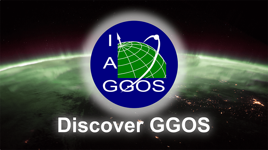
Do you know what geodesy is exactly and what GGOS does? This film immerses you in the world of geodesy and outlines its benefits for society.
The GGOS Coordinating Office has been working together with the GGOS and geodetic community on the production of the 8 minutes long film “Discover GGOS” to promote GGOS as well as geodetic observations, IAG services and geodetic products. The aim of this film is to explain and outline the benefits of geodesy in a simple way to students, non-geodesists but also to the whole society. In addition to the English film version, we have also produced the film in Spanish, German and Japanese to reach as many people as possible. Portuguese, French, Italian and Greek film versions are currently in production. To reach as many people as possible in their mother tongue, versions in Chinese, Russian and Arabic are also currently planned.
Please share this film with your colleagues, family members, and other interested people to bring them closer to the huge world of geodesy.
All versions are available at the GGOS YouTube Channel: https://www.youtube.com/c/GGOSGlobalGeodeticObservingSystem
MARTIN SEHNAL
Director of GGOS Coordinating Office
Meetings Calendar
IAG Sponsored Meetings
- IGRF Workshop 2022, April 11-13, 2022 Leipzig, Germany
- URL: https://www.iag-aig.org/events/67
- EUREF 2022 Symposium, June 1-4, 2022, Zagreb, Croatia
URL: https://www.igs.org/event/euref-2022-symposium/ - Spatial Data: science, research and technology 2022, May 23 – 25, 2022, Moscow, Russia
URL: https://scidata.ru/en2022 - X. Hotine-Marussi Symposium on Mathematical Geodesy, June 13 – 17, 2022, Milan, Italy
URL: http://icct.kma.zcu.cz/index.php?title=Hotine-Marussi_2022 - IGS Workshop "IGS 2022: Science from Earth to Space", June 27-July 1, 2022, Boulder CO, USA
- URL: https://www.igscb.org/event/
- 2nd International Symposium of Commission 4: Positioning and Applications, September 5-9, 2022, Potsdam, Germany,
URL: https://iag-commission4-symposium2022.net/ - Gravity, Geoid, and Height Systems 2022 (GGHS2022), September 12-16, 2022, Austin TX, USA
URL: https://www.csr.utexas.edu/gghs2022/index.html - REFAG 2022, October 17-21, 2022, Thessaloniki, Greece
URL: https://www.refag2022.org/ - Unified Analysis Workshop (UAW) October 22-25, 2022, Thessaloniki, Greece
URL: https://ggos.org/event/unified-analysis-workshop-uaw-2022/ - 22nd International Workshop on Laser Ranging, October 31 – November 4, 2022, Kunming, China
- URL: http://22ndilrs2020.csp.escience.cn
- 20th Assembly of WEGENER, october 25-29, 2022, Marrakech, Morocco, URL: https://wegener2021.sciencesconf.org
IAG Related Meetings
- COSPAR 2022, July 16-24, 2022, Athens, Greece
- URL: https://www.cospar-assembly.org
Further details are available in the IAG Event Calendar at: http://www.iag-aig.org/events.
Book review
Mission Earth
Geodynamics and Climate Change Observed Through Satellite Geodesy
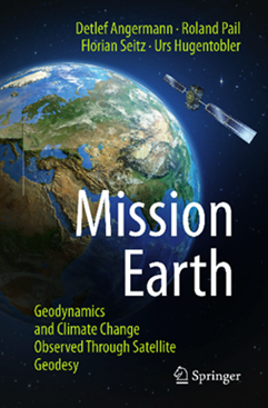
Detlef Angermann, Roland Pail, Florian Seitz and Urs Hugentobler
With interview contributions by Günter Hein, Harald Lesch and Stefan Rahmstorf
Springer-Verlag Berlin Heidelberg, 2022
ISBN 978-3-662-64105-7
ISBN 978-3-662-64106-4 (eBook)
Mission Earth
Such questions are highly relevant for our society - and are answered by geodesy. The central mission of the author’s team led by Dr. Detlef Angermann at the Technical University of Munich is to illustrate and explain precisely this. Thus, proven experts of global geodesy have come together to present their profound knowledge accurately, factually correct and, above all, easily accessible.
To understand the explanations, one does not need a degree in geodesy and certainly not a corresponding specialization. The book is explicitly written "for the curious". Formulas and derivations - unfortunately very often an argument against an in-depth study of the subject - are not found. Rather, our planet Earth with its complex dynamics is the focus of interest - and with it the current achievements and future possibilities of geodesy to contribute to a better understanding.
The book is divided into a total of five chapters. In a short introduction, the Earth is presented according to the modern view of systems theory as a dynamic planet, which consists of complex, interacting subsystems such as solid Earth, atmosphere, oceans or ice and which is subject to manifold changes. Climate change is already emphasized in the introduction as an example that is particularly visible to society. The chapter closes with the global view of geodesy on the Earth - illustrated by the three "basic pillars": geometry and kinematics, orientation and rotation, gravitational field. This clarifies the focus of the book and distinguishes it from an overall view of the geodetic portfolio.
Chapter 2 deals with the historical development of geodesy with regard to questions, tasks and methods from the first surveys in antiquity to the age of satellites. This storyline continues in Chapter 3 to describe and explain the approaches, tools, and contributions of global geodesy in the 21st century comprehensively, but - following the objective and the page size - not exhaustively. In Chapter 4, the focus of the considerations is put on the Earth system with the phenomena of global change. This emphasizes that the self-understanding of geodesy is not limited to a rather technological level. Dynamic processes of the solid Earth body, sea level changes or mass displacements in connection with the global water balance due to, e.g., ice melting in the polar region, are treated in detail. Essential statements about these changes, which affect us to a large extent in our everyday lives, are based on the fundamental findings of geodesy.
Already the preceding chapters are excellently written and extremely exciting to read. Finally, this is further enhanced in Chapter 5 by three interviews with renowned experts who are also known to the broader public. The content of this chapter is based on the societal relevance of the highly precise measuring of our planet from space. Prof. G. Hein, who played a key role in shaping the European satellite navigation system Galileo, looks at the importance of navigation systems in modern society. Prof. H. Lesch, known to a wider German audience through his science broadcasts, takes a holistic look at the Earth system. Prof. S. Rahmstorf, one of the lead authors of the Intergovernmental Panel on Climate Change's Fourth Assessment Report and an advisor to the German government, focuses on climate change and the threats it poses. The book concludes with a summarizing epilogue and a series of recommended readings to deepen and expand the presentations.
With this book, the authors have succeeded in an impressive way in presenting modern geodesy - using the example of global geodesy - in a lively and descriptive manner with regard to its possibilities and achievements and in placing it in the scientific and societal context. They have more than fulfilled their self-formulated claim, especially in times of "fake news", to "write down what we know for sure because we have measured it directly". Congratulations!
It is very worthwhile to read the book. Therefore, this book should be widely distributed in our professional community and its neighboring fields, in order to make the relevance and multitude of the geodetic contributions known far beyond science in the narrower sense - and thus to contribute significantly to the awareness and the positive image of geodesy, also supporting the recruitment of young people for our inspiring profession.
Hansjörg Kutterer, Karlsruhe
This book review is an authorized translation of the original German “Buchbesprechung” by Hansjörg Kutterer, published in zfv – Zeitschrift für Geodäsie, Geoinformation und Landmanagement, Heft 2/2021, 146. Jahrgang, Herausgeber: DVW e.V. – Gesellschaft für Geodäsie, Geoinformation und Landmanagement, ISSN 1618-8950. The translation was done with the help of artificial intelligence (machine translation by the service DeepL.com).
Obituary
George Veis (1929-2022)
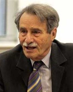
The international scientific community has lost a distinguished member in the field of Geodesy. George Veis passed away on January 25, 2022, following an exceptional scientific career.
He started his journey by completing his first degree in the School of Rural and Surveying Engineering (SRSE) of the National Technical University of Athens (NTUA), followed by post graduate studies, initially in France at the Sorbonne, the Ecole Nationale des Sciences Geographiques, the Observatoire de Paris and the Bureau Gravimetric International, and later in the USA at the Institute of Geodesy Photogrammetry and Cartography of the Ohio State University. He had the opportunity to study among enlightened scientists in the field and completed his PhD thesis titled "Geodetic Applications of observations of the Moon, Artificial Satellites and Rockets" in 1958 under the supervision of the famous Finish geodesist, Prof. W. Heiskanen. His thesis was the first concise text on Satellite Geodesy, and it was therefore considered a milestone in the history of Geodesy. His publications relating to the use of artificial satellites for the determination of the size and shape of the Earth have become a reference point to all scientists involved in modern geodesy. Prof. George Veis has often been referred to as the father of Satellite Geodesy.
In 1959, he was elected Professor at the SRSE of the NTUA and in parallel continued his research activities using terrestrial and satellite geodesy methods. During the period 1958-1979 he was consultant at the Smithsonian Astrophysical Observatory (SAO) (Harvard Smithsonian Center of Astrophysics) and Research Associate at the Harvard Observatory. In 1966, George Veis had a significant contribution to the well-known publication Standard Earth, which was considered a fundamental work in the field of Satellite Geodesy. In 1967, with the support of NTUA and SAO, he established the Dionysos Satellite Centre (DSC) where he designed the Laser ranging system. Under his supervision, DSC participated in many International and Hellenic geodetic and geodynamic research programs. Later on, the DSC became one of NTUA's Laboratories.
As a consultant to the SAO, George Veis organized an international network of artificial satellite tracking stations that collected data from which new values for the dimensions of the Earth were derived. Very few people are aware that the precise star catalogue in the FK4 system, known as “SAO STAR CATALOGUE”, was conceived and compiled by George Veis. During the period 1965-1984, he organized International Symposia on “The use of Artificial Satellites for Geodesy and Geodynamics” whose Proceedings (five volumes) may be considered as a gift to the history of Geodesy.
Throughout his career, he was an active member of the international geodetic community, serving as President or member of Sections and Working groups of the IAG, IUGG and COSPAR. Acknowledging his international activities and contributions to Satellite Geodesy, IAG named him a Fellow of the IAG.
One should not think that George Veis was only a theoretical scientist; he had always been a man of action that enjoyed field campaigns and experiments. I can never forget the 18 days we spent together 49 years ago on the remote island of Othoni in northwest Greece. To materialize one of his innovative ideas, we transferred on the island all the bulky Laser System equipment from Dionysos, together with all the electronic devices needed and 'forced' the system to measure the distance between Greece and Italy. The distance was eventually measured after overcoming many difficulties, mainly due to the adverse weather conditions. The distance, together with astronomic and other geodetic observations, provided valuable information concerning the position and orientation of the Hellenic Geodetic Network relative to the European one. These achievements were very significant considering the available technology of that time worldwide (1973).
George Veis was actively involved in the administration and management of NTUA and worked towards the improvement of academic life and programs, even during a very dark, politically, period for Greece, the Colonels’ Junta. In 1973 he was arrested, as his initiatives were not acceptable to the Junta’s administration. The international scientific community from the USA, UK and western Europe had a very efficient mobilization and reaction, contributing to his release within a month. As a member of the Senate of NTUA, Dean of the SRSE, Director of the Department of Topography, and Head of the Laboratory of Higher Geodesy, he played a leading role in the reformation of the educational system of NTUA and the curricula of the SRSE.
He always helped and guided young colleagues, ensuring their development and advancement. A significant number of his former students are members of teaching and research staff in Universities and research organizations in Greece and abroad. George Veis’ former students organized in 1992 an International Workshop on Global Positioning Systems in Geosciences at the Technical University of Crete Chania, Greece, which was dedicated to him.
In 1987, while carrying out his research on Reference Systems for Geodesy and Astronomy, he proposed a new Geodetic Reference System for Greece. The System HGRS87 (Hellenic Geodetic Reference System 87) was adopted by the Greek State and is being used by engineers involved in surveying measurements and cadastre. His research also focused on Geodynamics, by monitoring crustal movements in the seismically very active Hellenic area using Satellite Geodesy techniques. He also carried out research on Navigation and Cartography.
His significant contributions to the international scientific forum have been acknowledged internationally. In 1994, the Technical University of Zurich (ETH) awarded him the title of “Honorary Doctor”. In 1998, soon after his retirement, he was awarded the title of Professor Emeritus of NTUA and in 2001 the SRSE and the Senate of NTUA honored George Veis by naming a new building of SRSE after him. In 1998, with the unanimous decision of past IAG Presidents, the “Levallois medal” was awarded to George Veis for his outstanding contributions to the science of Geodesy. In 2003, he was elected Member of the Academia Europaea (Section Earth and Cosmic Science), and in 2013 he was awarded the medal of “Officier” of the “Ordre des Palmes Academique” of the French Republic.
In parallel to his academic activities, George Veis had always offered his vast experience, knowledge and service wherever needed. He had served for many years as General Secretary and President of the Hellenic National Committee for Geodesy and Geophysics, President of the National Observatory of Athens, President of the Hellenic National Space Committee, President of the National Advisory Council and President of the Hellenic Mapping and Cadastral Organization. During all these years, he had also a constant and close collaboration with the Hellenic Army Geographical Service (HAGS). George Veis served on Greece's “Supreme Council for Civil Personnel Selection” for 20 years (1994-2014), the last 11 years as President, and after his retirement he became Honorary President. He contributed significantly to the organizational structure of the Council and the upgrading of the competition procedures, by introducing digital technology to guarantee the most impartial selection of the appropriate personnel, thus fulfilling the role of the Council. It should be mentioned that, due to the requirement for a distinguished impartial personality, the President of this Council is appointed by the Hellenic Parliament.
The 2009 ILRS Technical Workshop on “SLR Tracking of GNSS Constellation” that took place in Metsovo, Greece, besides being a celebration of 50 years of Satellite Geodesy, also celebrated George Veis’ 80th birthday, acknowledging his profound contribution to the field.
George Veis was loved and respected by all his students, colleagues and friends as his notable scientific competence was combined with high personal qualities, such as integrity, modesty, generosity, friendliness, understanding, and a strong sense of humour. He will undoubtably be sorely missed.
I consider myself privileged to be one of George Veis’ first students, assistants, and collaborators at NTUA. Thus, after more than 60 years of friendship and excellent cooperation with such an exceptional person, I feel a great loss.
George Veis is survived by his wife of 50 years, Katerina, his daughter, three sons and five grandchildren, who were all an invaluable and beloved part of his life.
D.D. Balodimos, D.Phil Oxon
Professor Emeritus NTUA
Former Vice Rector of NTUA
Athens, 11 February 2022
The IAG Newsletter is under the editorial responsibility of the Communication and Outreach Branch (COB) of the IAG. It is an open forum and contributors are welcome to send material (preferably in electronic form) to the IAG COB (newsletter@iag-aig.org). These contributions should complement information sent by IAG officials or by IAG symposia organizers (reports and announcements). The IAG Newsletter is published monthly. It is available in different formats from the IAG new internet site: http://www.iag-aig.org.
Each IAG Newsletter includes several of the following topics:
- news from the Bureau Members
- general information
- reports of IAG symposia
- reports by commissions, special commissions or study groups
- symposia announcements
- book reviews
- fast bibliography
| DOCUMENTS |
| IAG_Newsletter_February_2022.pdf |